Using crowdsourced info from BikeSpot 2023, here’s a deep dive into where people feel safe riding bikes around Hobart and where they don’t.
What is BikeSpot 2023?
BikeSpot is a crowdsourced map showing where Australians feel safe and unsafe riding their bikes. The 2023 version of the map included Tasmania and people marked hundreds of spots around Hobart.
Where in Hobart do people find it safe to cycle?
People genuinely appreciate the safer bike infrastructure in Hobart. Here are the most popular safe spots.
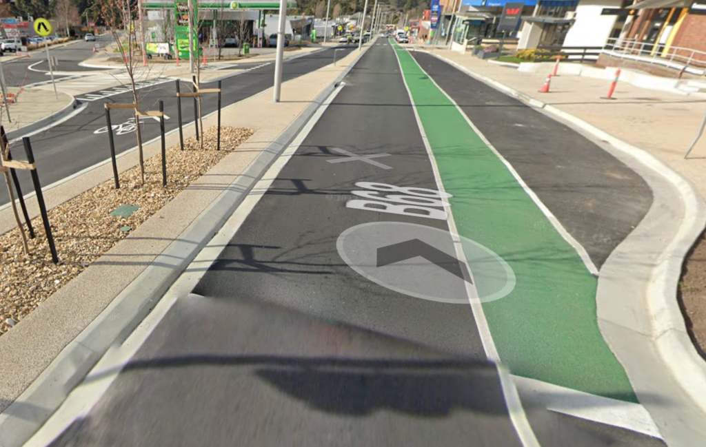
- Intercity Cycleway (map) — Unsurprisingly this off-road shared use path gets some love. “Best piece of active infrastructure Tasmania ever had”. “Like being in the eye of the storm”.
- Clarence Foreshore Trail (map) — Lots of people like this off-road shared use path along the foreshore, especially the Howrah to Tasman Bridge section.
- Hobart Rivulet Track (map) — This wide off-road shared used trail along the rivulet with bonus platypuses is well liked.
- Molle & Collins Street intersection (map) — People feel much safer crossing here now the new traffic lights create gaps in the 50 km/h traffic.
Where is unsafe to ride in Hobart?
Unsafe spots far outweigh safe spots on the map. Some of the unsafe spots are well known to be problematic. However there’s also many less obvious big and small issues raised. Here’s a selection of the most supported unsafe spots.
Hobart approaches
- Tasman Bridge (map) — Unsurprisingly listed as unsafe by many many many people. The state government is planning modifications but the bridge will remain unsafe even after these are implemented.
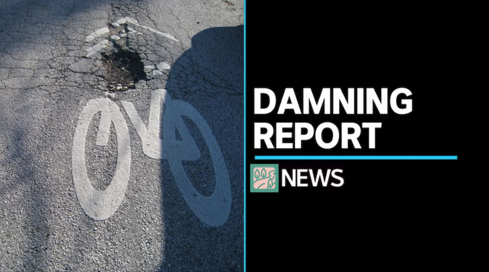
- Intercity Cycleway (map) — Best active transport infrastructure in Hobart it may be but there’s still plenty of issues. The poorly designed road crossings received a plethora of comments and clearly should be a priority for the two relevant councils — see our thoughts on the Queens Walk crossing. Inadequate lighting & access north of the bridge leaves many feeling unsafe and poor surfacing is an issue at certain points. Continuing into town the dogleg near the Royal Engineers Building (map) has a lot of people puzzling how it’s been rebuilt recently and yet is so bad for bikes and pedestrians. The traffic lights at the Evans Street intersection (map) are also felt by many to be suboptimal.
- Hobart Rivulet Track (map) — Well liked but also plenty of room for improvement. Slippery surface, inadequate lighting, obstructive bollards, narrow sections and poor signage (see Sign Spot 8) were some of the issues raised.
- Sandy Bay Road bike lanes (map) — People clearly don’t feel these bike lanes provide enough safety. Not physically separated, traffic side of parked cars in the door zone, often obstructed by parked cars, faded paint, sometimes sharing the footpath with pedestrians, and narrow or even nonexistent at points. The fact they don’t continue past the casino results in substantial safety concerns on Sandy Bay Road as it nears the city. There is a plan for much better bike lanes here but it seems far off. Hopefully the obvious demand along with the need for last mile connections to the planned ferry terminal will mean it’s prioritised.
Hobart city
- Waterfront (map) — Many comment that the lack of a bike lane that is unambiguously separated from pedestrians makes riding along the waterfront less safe and convenient than it could be. This is applicable at many points including the newly refurbished part of Salamanca.
- Campbell / Argyle / Bathurst / Liverpool Streets (map) — The new bike lanes are fixing some of the safety concerns in this area. However the spot considered most unsafe here is the block of Argyle Street with the council carpark and it hasn’t been upgraded. Similarly the access to the Rose Garden Bridge isn’t being improved and there won’t be a contra-flow lane on Bathurst Street. Read our summary of these new bike lanes.
- Collins Street (map) — There’s clear demand for bike lanes along Collins Street including a contra-flow lane between Elizabeth & Murray Streets. Discussed for decades, City of Hobart is now in the final stages of designing changes including bike lanes to be made here soon.
- Burnett / Argyle / Campbell Streets (map) — Heading into the city down Argyle Street requires cars and bikes alike to turn left into Burnett Street then immediately right into Campbell Street. Many people find this unsafe on their bike. This point-of-view video gives a good idea of the issue when turning into Burnett. The recent addition of a paint-separated bike lane on the corner leading into Campbell has been assessed as safer-but-not-safe-enough.
Clarence
- South Arm Road between Oakdowns & Lauderdale (map) — Narrow, no verge, high traffic speed & volume, poor visibility due to curves & crests, no alternative route, near misses with trucks. This is a genuine bike blackspot. And while the state government is already planning to upgrade South Arm Rd, it’s focused on vehicles and this particular section is not a priority — read our summary of that project.
- Mornington roundabout and surrounds (map) — A number of people point out that these high speed roads don’t have corresponding bike or pedestrian routes. Especially problematic given people would like to ride (often with kids) to the Clarence Mountain Bike Park.
- Clarence Foreshore Trail — While generally considered a safe route, the sections over the second bluff (map) and through the yacht club carpark (map) are felt to be unsafe by some. There’s also a sensible suggestion it gets swept regularly to remove gravel and debris.
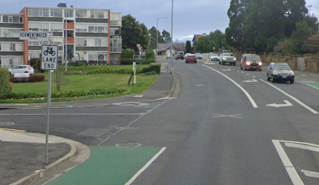
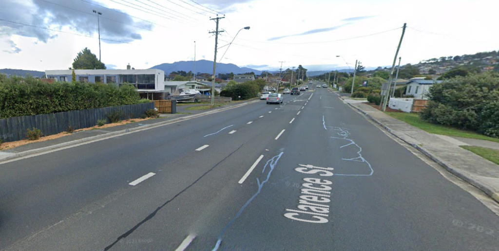
- Clarence Street (map) — Plenty of comments that this 60 km/h high traffic street is begging for bike lanes. This was actually on the cards in 2017 but City of Clarence’s traffic/civil engineers inexplicably recommended against them despite community support (pages 118-144 in this council agenda). Nonetheless it’s part of the Greater Hobart Cycling Plan, plus there’s now a ferry terminal at one end and one planned for the other end. Time this was revisited.
Kingston
- Roslyn Avenue (map) — This important route between Blackmans Bay & Kingston doesn’t have any bike infrastructure. People find the road unsafe to ride on because it’s narrow, has uphill sections, is high traffic and they frequently experience poor driver behaviour. It’s a key route on the Greater Hobart Cycling Plan and the site of two primary schools.
- Beach Road (map) — The on-road painted bike lane suddenly stops without even a ramp onto the footpath. The beach is an obvious destination for riders including kids, even before the ferry comes. The route is on the Greater Hobart Cycling Plan yet planned upgrades don’t include bike infrastructure.
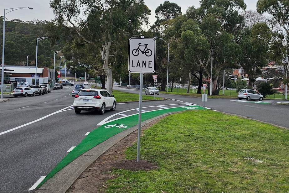
- Channel Highway in the Kingston CBD (map) — People report feel unsafe using this new bike lane because it’s narrow, not physically separated and located between traffic & parked cars. It’s also one direction only.
Our thoughts
The information on BikeSpot provides an excellent snapshot of where Hobart is at in terms of bike infrastructure and safety. Frankly, it’s damning.
The key takeaways:
- The level of engagement makes it clear there’s strong demand for better bike infrastructure in Hobart.
- People are choosing not to ride many routes because they don’t feel safe.
- People do appreciate the better bike infrastructure in Hobart.
- However even the best infrastructure in Hobart is not as safe as people want.
- On-road infrastructure is infrequently marked as safe suggesting this type of infrastructure is not being done well in Hobart.
- Even infrastructure that is brand new or being planned is not meeting community expectations for safety.
- Issues are widespread — no council or government is providing adequately safe bike infrastructure in Hobart yet.
Where to from here?
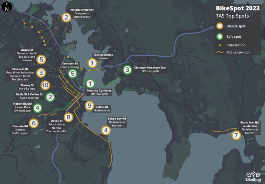
The data collected by BikeSpot 2023 has been summarised in a national report which is worth reading. The report includes a summary of the top spots in Tasmania which is remarkably similar to our analysis:
NSW and Greater Bendigo commissioned their own reports. Tasmania and Hobart have not.
Hopefully the greater Hobart councils and the state government will at least go through the data in the map in detail. As we’ve shown in our analysis above there’s many insights to be gained.
As always, you should let them know what you think.