What’s the issue?
Pedestrian and cycle routes need signage to help people find their way in the same way that roads do. These wayfinding signs aren’t always top priority when building infrastructure and are often overlooked. Hobart has many places that could be better signed.
Such as where?
Let’s look at an example: the area around the Bridge of Remembrance. This is the pedestrian & cycle bridge that crosses the Tasman Highway from the Cenotaph to the Domain. Built in 2019. It connects places like the Intercity Cycleway and the waterfront with the Hobart Aquatic Centre, the Soldier’s Memorial Avenue and the city via the Rose Garden Bridge.
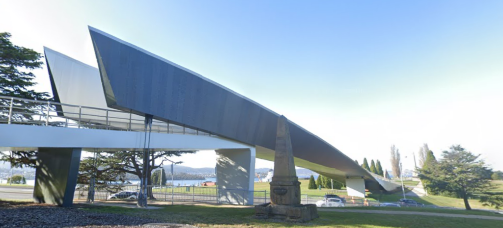
It’s clearly an important route for walkers and bike riders alike. It’s an area that even has its own wayfinding plan, endorsed by City of Hobart back in 2020.
So let’s look at a few key spots around the bridge.
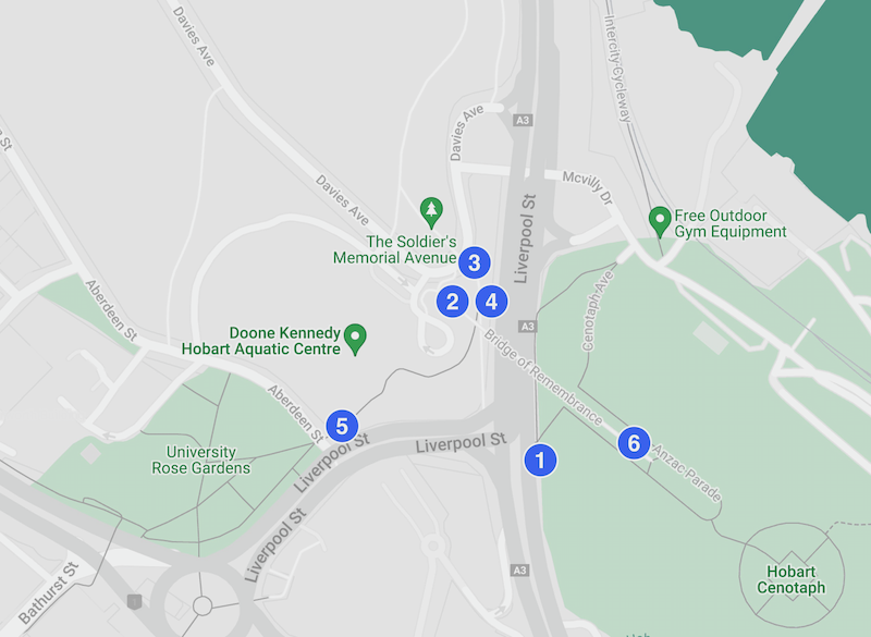
Six example Sign Spots
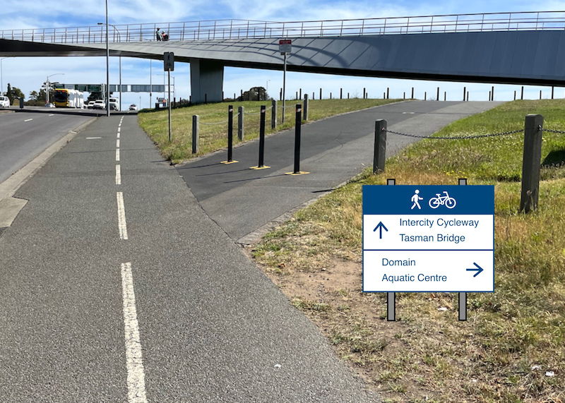
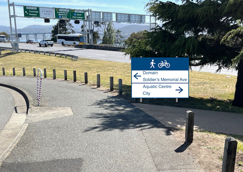
- Approaching the eastern end of the bridge from the city. A Y‑intersection with no existing signage — we’ve added some.
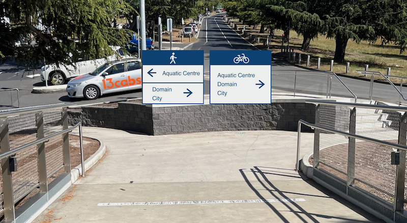
- Coming off the western end of the bridge. A T‑intersection with no existing signage — we’ve added some.
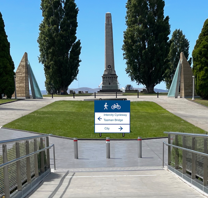
- Soon after turning right at the western end of the bridge. A cross‑intersection with no existing signage — we’ve added some.
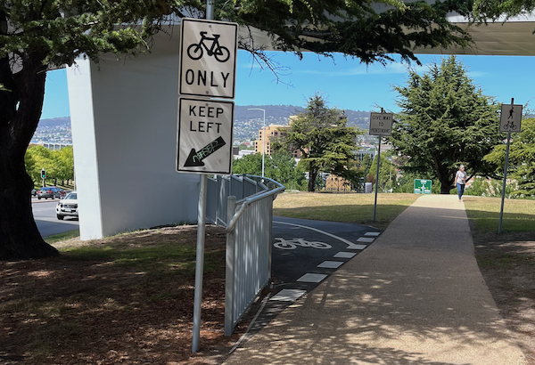
- Just under the western end of the bridge after taking the right turn at spot 3. A Y‑intersection with existing signage.
There may be multiple signs already but they aren’t helpful. How many people have ended up down by the tree & bridge pylon! This is well meaning but indicative of a struggle to sign a complicated intersection with standard road signs.
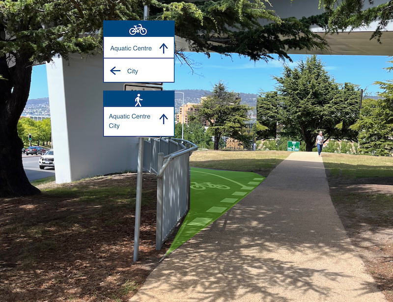
- Spot 4 again — this time with new signage and a splash of green paint.
(With wayfinding signage for each direction, the existing Give Way to Pedestrians and shared use path signs would be redundant).
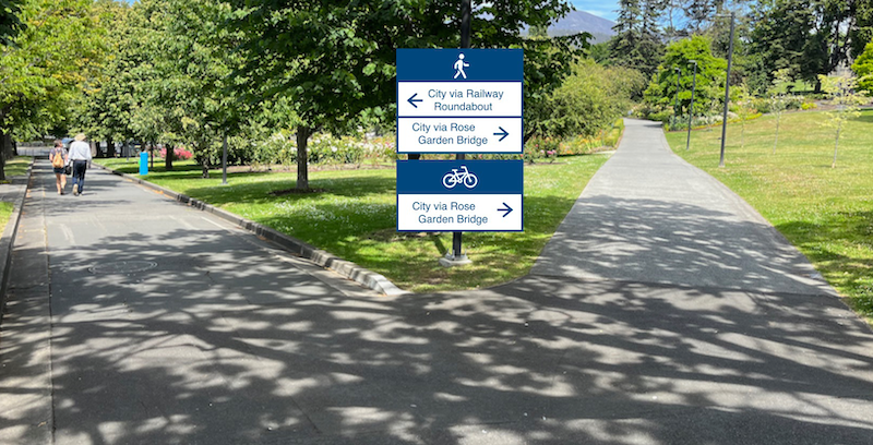
- Just after entering the Rose Garden heading to the city from the western end of the bridge. A Y‑intersection with no existing signage — we’ve added some.
- Coming off the eastern end of the bridge on the way back. A T‑intersection with no existing signage — we’ve added some.
(This sign could really be placed more aesthetically but you get the idea).
What makes wayfinding signs a good idea?
- Wayfinding signs make walking & cycling easier. This encourages people to choose active transport and improves the visitor experience of Hobart too.
- They help formalise the routes which raises community awareness of their existence. As well, it brings overall network connectivity into focus for transport planners.
- Signs are cheap, at least compared to other infrastructure.
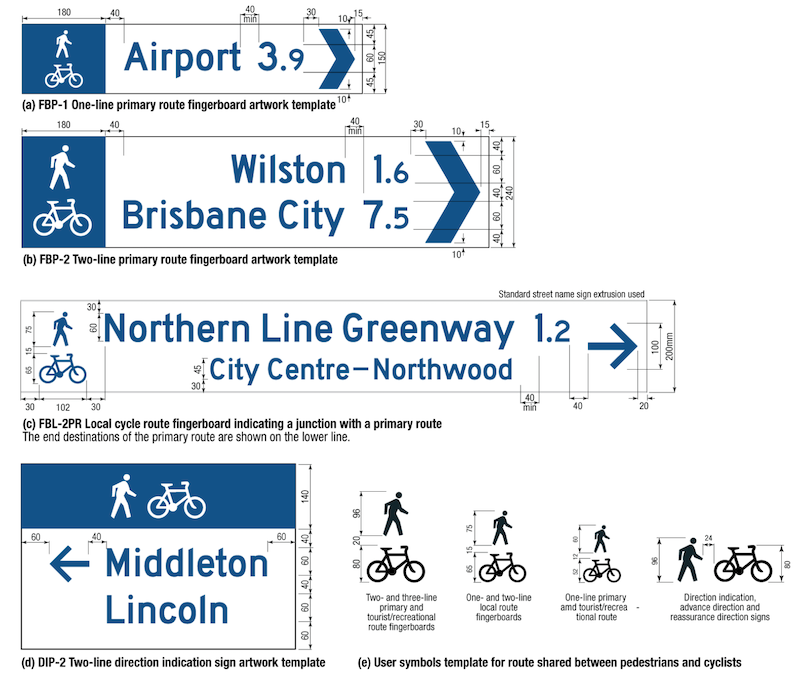
- It’s an easy project to implement as far as infrastructure projects go. Detailed designs for the signs already exist (see below). All that’s needed is for someone good at wayfinding to plan where the signs go and what they say. Then make the signs and concrete them into place. Repeat as necessary.
Submit your Sign Spot!
We want to improve this and we need your help!

Snap a photo of a spot you’ve found around Hobart that would benefit from a wayfinding sign for pedestrians and/or cyclists . Then submit it here and we’ll add it to the crowdsourced collection.
And if you see a good wayfinding sign already out in the wild, we’d love you to submit a photo of that too!
How else can I help?
Let the councils know you think this is a great idea
Share this post