The Tasmanian Department of State Growth is in the early stages of planning a big expansion of ferry services on Hobart’s Derwent River.
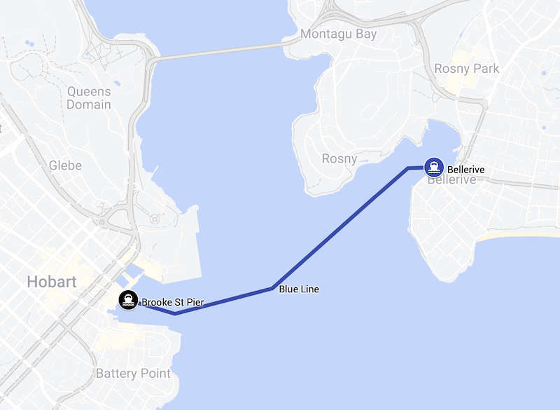
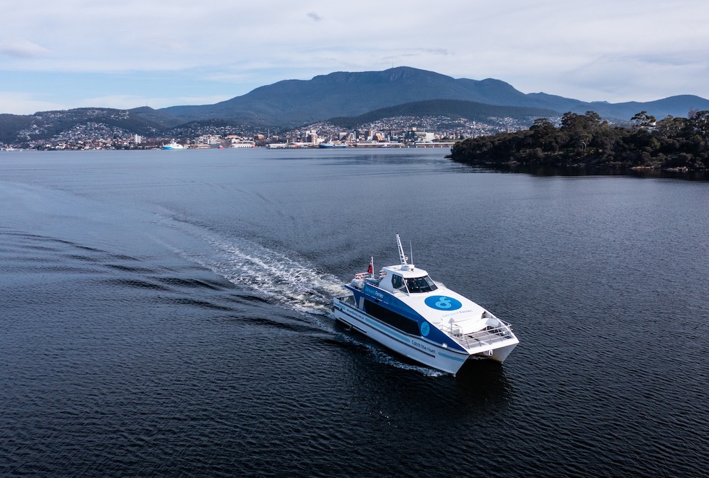
For now Hobart has just one public ferry service. That ferry travels between Bellerive and the city during weekday peak periods and on Saturdays. The service began as a one year trial in 2021 but its popularity ensured it has continued beyond the trial period.
What’s the expansion plan?
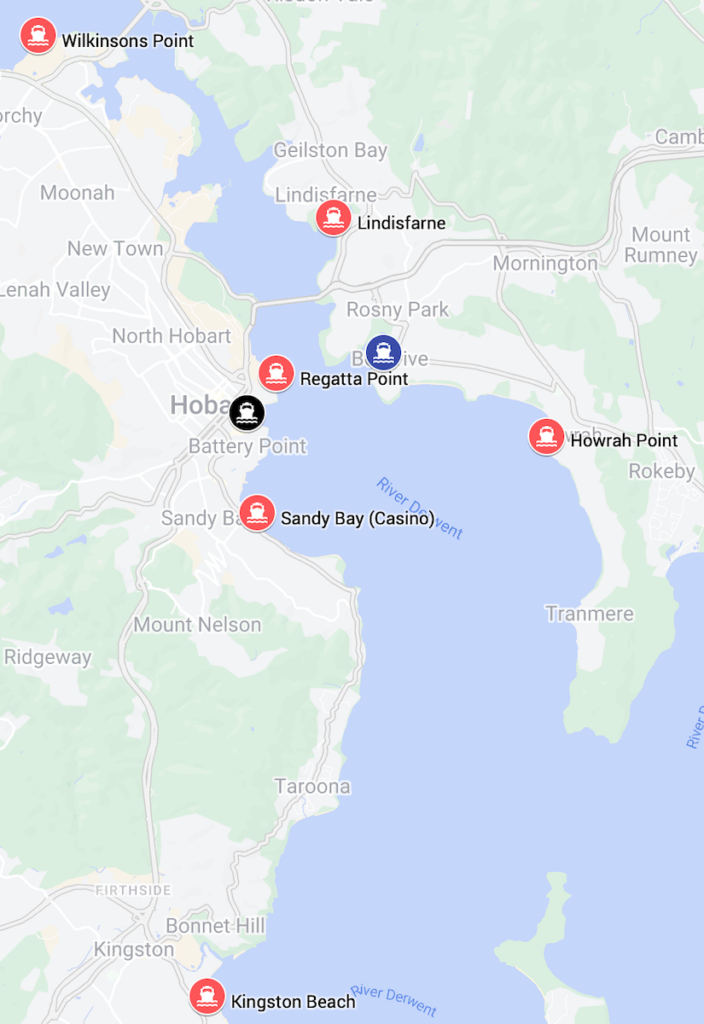
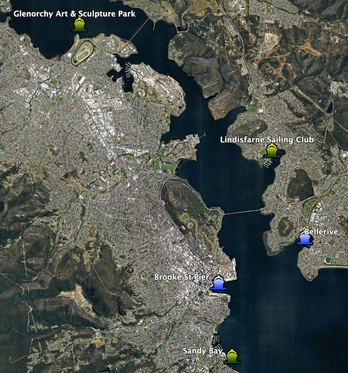
Six new wharves
- Wilkinsons Point — near MyState Bank Arena aka the DEC
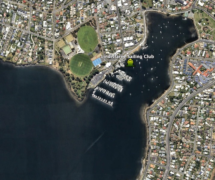
- Lindisfarne
- Regatta Point
- Howrah Point
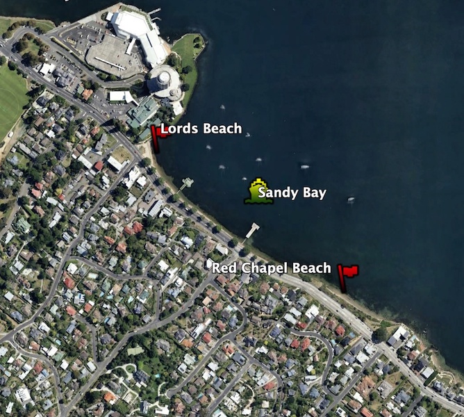
- Sandy Bay (Casino)
- Kingston Beach
Why those sites?
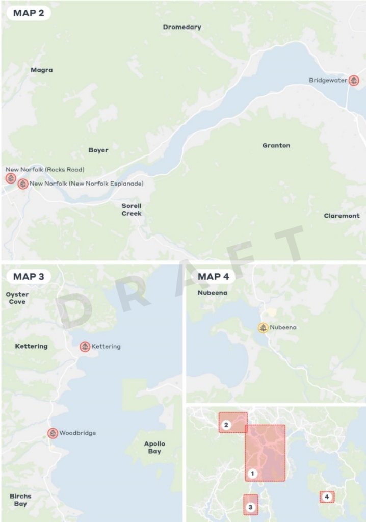
A total of 33 sites were considered. They cover a wide area — from New Norfolk to Woodbridge to Nubeena.
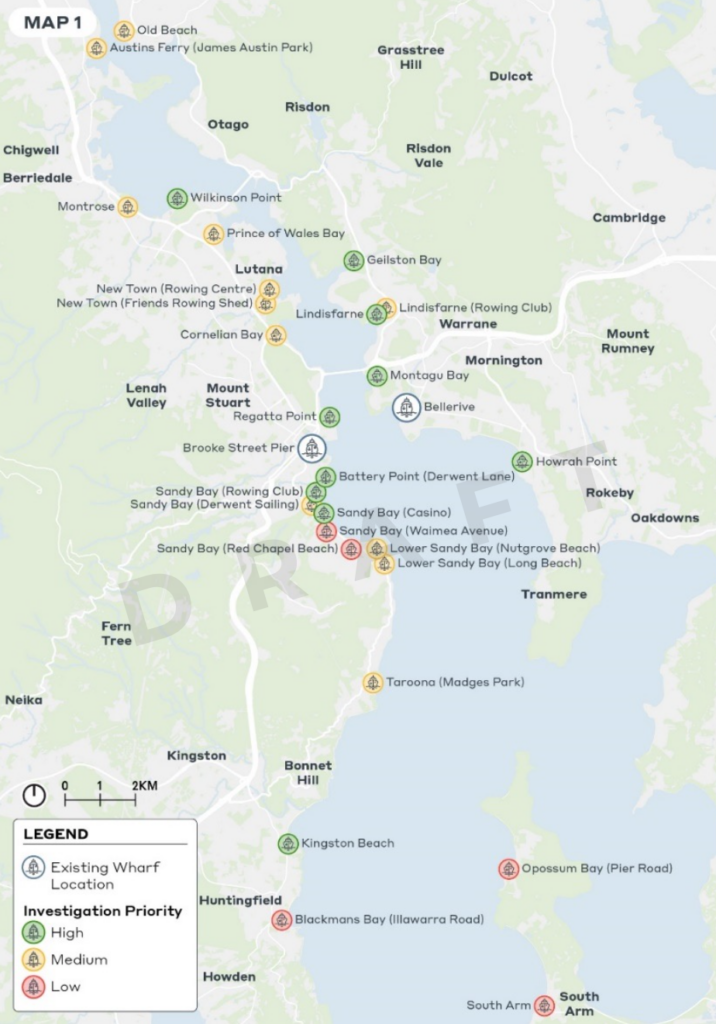
The initial assessment of the sites included many factors — things like ease of navigation, wave exposure, potential patron demand, degree of traffic congestion, existing public & active transport, and much more. The result was an objective score ranking the sites. The 8 highest ranked sites plus 2 others identified as important by the councils then underwent a second stage of assessment resulting in the final 6 sites.
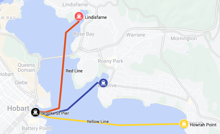
Staged expansion of routes
Expansion Stage 1 is directed at easing congestion on the Tasman Bridge. It adds two new routes.
- Red Line:
Lindisfarne—City
(weekday peak & offpeak) - Yellow Line:
Howrah Pt—City
(weekday peak & offpeak)
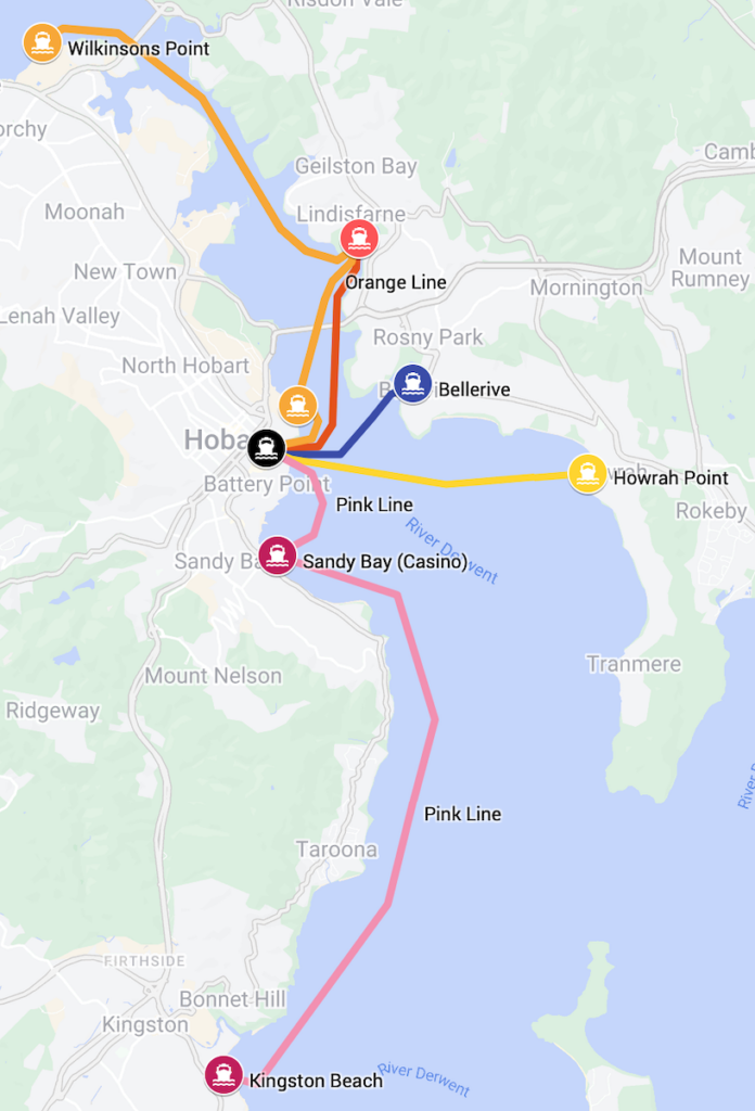
Expansion Stage 2 adds further connectivity.
At peak times there would be two additional relatively direct routes — one north of the city and one south of the city.
- Orange Line:
Wilkinsons Pt—Lindisfarne—Regatta Pt—City
(weekday peak) - Pink Line:
Kingston—Sandy Bay—City
(weekday peak)
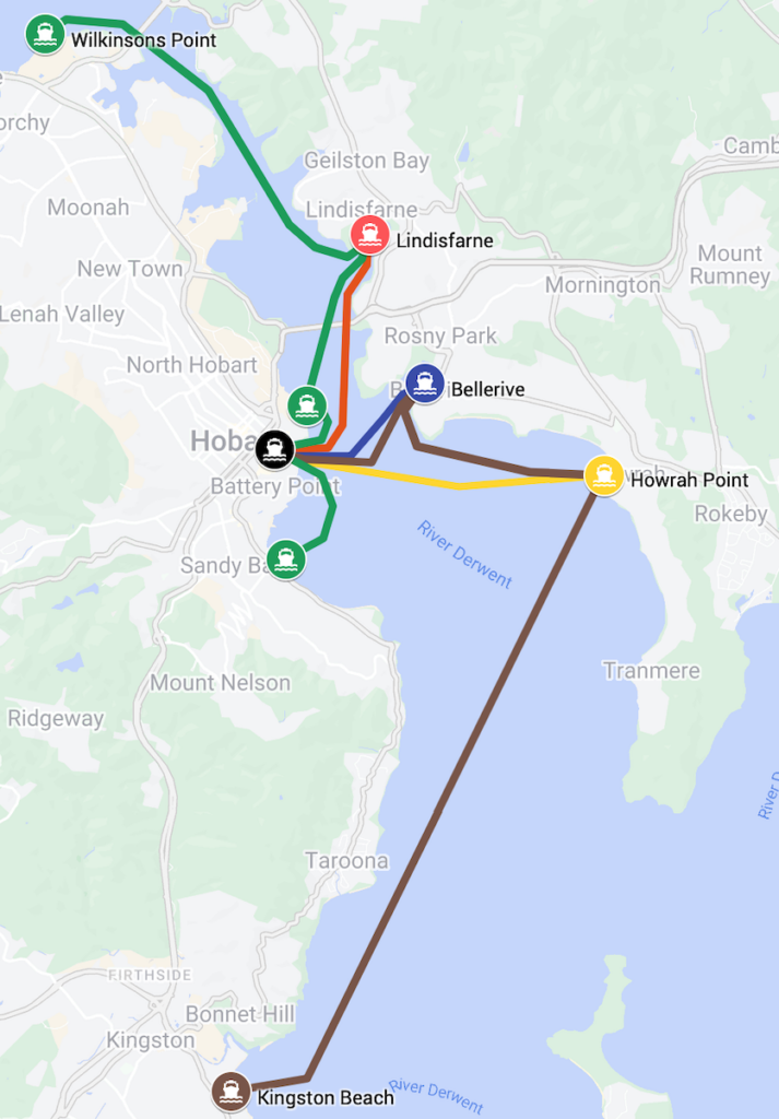
Outside of peak times these two routes would be replaced by two less direct routes.
- Green Line:
Wilkinsons Pt—Lindisfarne—Regatta Pt—City—Sandy Bay
(weekday offpeak, weekends & events) - Brown Line:
Kingston—Howrah Pt—Bellerive—City
(weekday offpeak, weekends & events)
Future network expansions beyond these routes are ‘not precluded’.
What will the wharves be like?
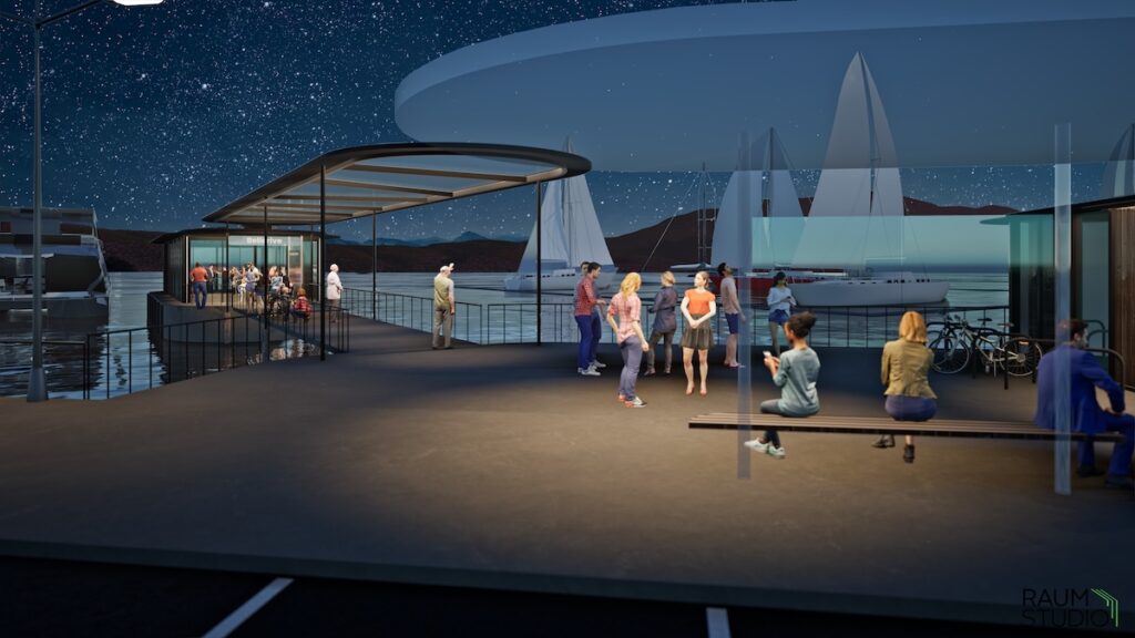
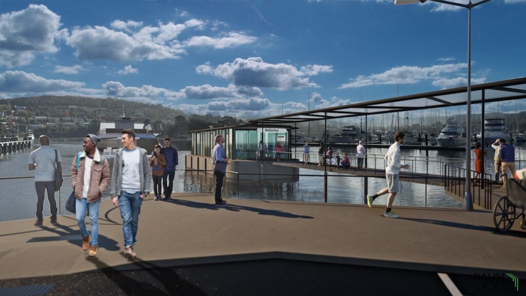
A concept design for an upgraded Bellerive ferry terminal was released in October 2024. It will be fully accessible and will include indoor waiting areas, improved seating for a larger number of passengers and bicycle storage options. The design will also be used as the model for the three new ferry terminals.
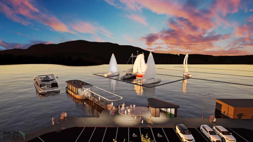
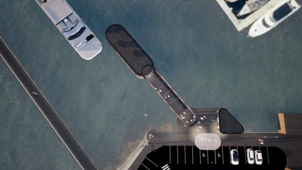

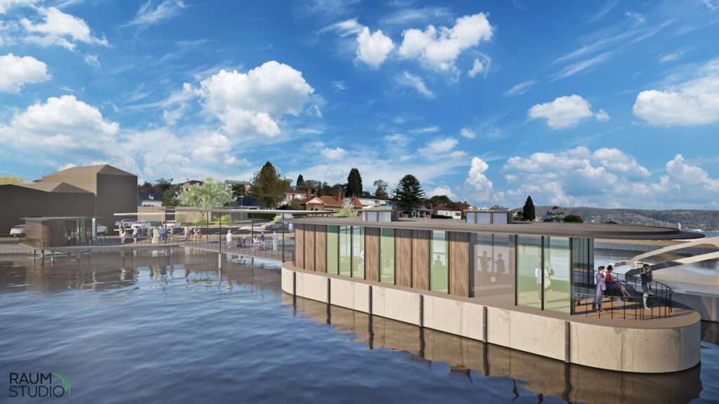
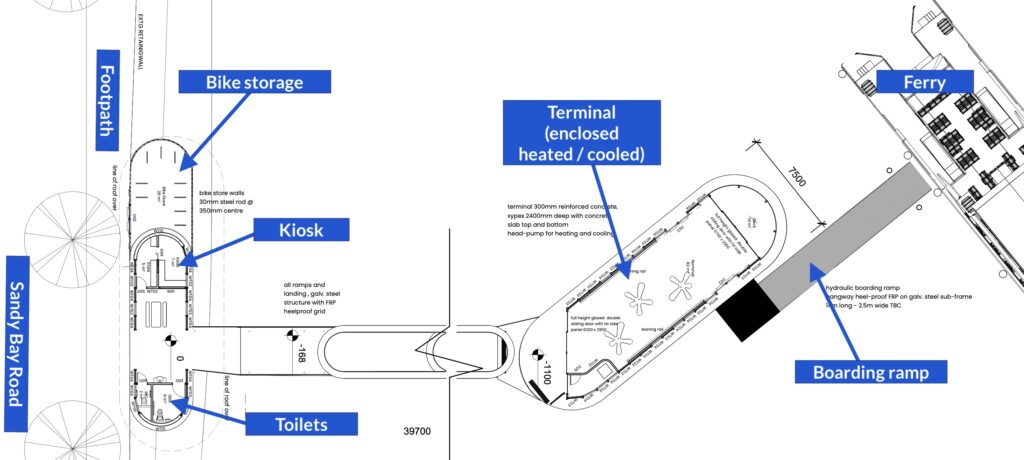
A concept design for the new Sandy Bay ferry terminal was released by City of Hobart in December 2024. The terminal is sited between the two existing private jetties between Lords Beach and Red Chapel Beach, just south of the Wrest Point Hotel.
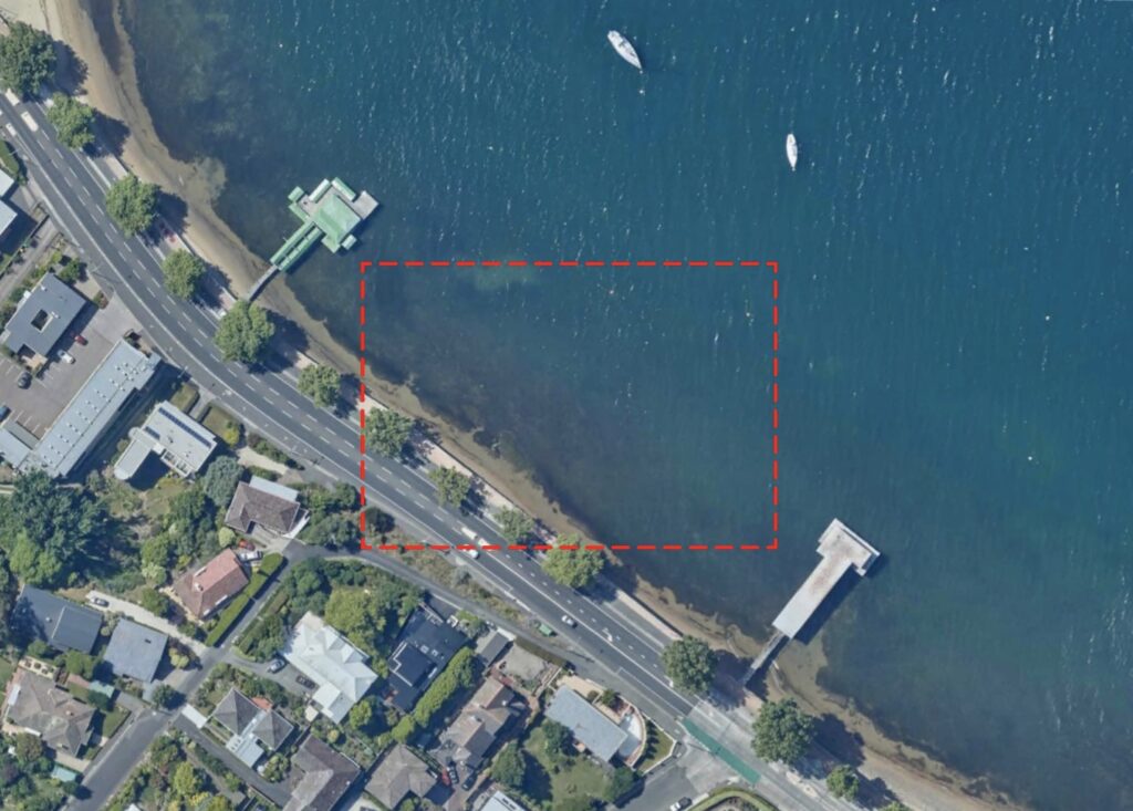
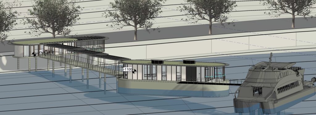
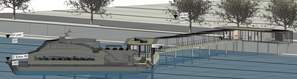
The design shows a building on land with a kiosk, toilets and a bike store. A walkway connects to an enclosed terminal over the water. A boarding ramp allows access to the ferry.
What will the ferries be like?
The details of the ferries haven’t been decided at this stage. It’s implied they’ll likely be fuelled by diesel but hydrogen or batteries are mentioned as possibilities depending on how fast technology advances.
How will people get to the wharf?
It’s clear the plan is not for large carparks on the waterfront to facilitate a park and ride service. The main reason given for this is that waterside land is too valuable, both in dollar terms but also in opportunity cost — essentially the land could be much better utilised for other purposes. Wharves will include vehicle facilities such as passenger drop off / pick up and/or accessible parking.
The plan states that most ferry patrons come from within walking distance of ferry wharves. As such the wharves will require connections to walking and cycling routes — the proposed Queen Street shared path being a good example.
Is it funded?
Ferries on the Derwent River was part of the Hobart City Deal agreed to by the Australian & Tasmanian governments and the four greater Hobart councils. In theory this means all levels of government are dedicated to working together to achieve this project. However to date the only funding commitment was made by the Australian government to the councils at the 2021 federal election. This was for $20 million towards expansion and ongoing operation of ferry services including four all-weather floating jetties & ferry terminals at Bellerive, Lindisfarne, Sandy Bay and Wilkinsons Point.
Our thoughts
The good
- New public transport! Meaning some people will have the option to not use their car for some trips. This will improve traffic congestion in a way that building new roads never will.
- Ferries don’t share roads with all the other forms of transport. Their routes are sitting there essentially empty and ready to go. Travel times should be reliable. They’re also not impacted by road incidents — like a crash on the Tasman Bridge — which will provide a much needed degree of redundancy in Hobart’s transport network.
- People love ferries. They’ll often choose them even if they’re not the fastest or most convenient method of travel for their trip. Visitors to Hobart will use them and travel to parts of the city they might not otherwise — Kingston Beach for example.
- The plan recognises the importance of active transport. Promoting active transport is one of the guiding principles for the ferry expansion. Existing active transport infrastructure was factored into the selection of the ferry wharf sites. The plan acknowledges that active transport will be the most important method for ferry patrons to arrive at the wharves. The specifications for the ferry wharf infrastructure includes active transport links. Also included is parking for bikes & micro-mobility devices including charging.
The less good
- Theres’s a significant focus on peak hour services. This ignores the reality of modern work life: people head to the gym before work, go out to dinner or the pub after work, work longer than standard day shifts starting early or finishing late, work flexible hours so they can pick up kids from school, and so on. This also fails to recognise that trips made outside of peak hours indirectly impact on congestion. For example, less demand for parking from daytime shoppers means more space for pedestrian & bike infrastructure and bus lanes, which means more peak hour trips via active & public transport. Another example: someone who has a good experience using the ferry to go to Kingston Beach on the weekend is then more likely to consider the ferry or other public transport for their commute to work.
- The proposed wharf locations don’t necessarily make sense from an overall network perspective. For example, why would a ferry en route from Kingston Beach to the city pass Taroona without making a quick stop near the large waterfront high school? Aside from event days would Wilkinsons Pt see enough patronage to justify the long trip from Lindisfarne with no other stops? There’s also no mention of Mona being investigated as an option.
- It’s largely unfunded.
The uncertain
- Ferries can only ever be a complement to a larger public transport network. They’re also a relatively expensive form of public transport. It can still be justifiable to spend the money for all the reasons above and public transport’s value is not the small amount of revenue it generates. The key is that the core part of the public transport network — in Hobart that’s buses — must also receive the funding it needs for service improvements and expansion.
- The project is still in the pre-planning and concept stage and the Masterplan reflects this. The funding model hasn’t been confirmed, there’s no genuine costings, travel times haven’t been estimated, the size & number of ferries isn’t specified, the impacts of weather on the chosen wharf locations hasn’t been considered, and so on.
- Lots of factors suggest this a difficult project to achieve, let alone to a reasonable budget or timeline. It involves six government bodies from three levels. Likely one or more private service providers as well as integration with Metro Tasmania services. The Department of State Growth as the coordinating body doesn’t have control of the already committed funds. No agreed model for funding both the remainder of the capital investment and ongoing costs. And so on. The risk assessment only partially & briefly mentions these factors: “differing views on priority between the Tasmanian and local Governments”. For this project to succeed it will require strong political will and skilled management.
Where to from here?
Community consultation on the masterplan closed on 8 January 2024. Feedback is currently being reviewed.
New terminals
The Tasmanian Liberal party promised before the March 2024 state election that a “re-elected majority Liberal Government ” would build three new ferry terminals over the next four years, commencing with Lindisfarne Bay, followed by Sandy Bay and Wilkinsons Point — terminals to be operational progressively from 2026 to 2028.
May 2024, — geological testing undertaken in the vicinity of the Lindisfarne Sailing Club as part of preliminary site assessments for potential ferry terminal locations. City of Hobart on behalf of the four Greater Hobart councils engaged Burbury Consulting to do the assessments.
June 2024 — three specific ferry terminal sites recommended by Burbury Consulting:
- Lindisfarne Sailing Club
- Sandy Bay between Lords Beach & Red Chapel Beach
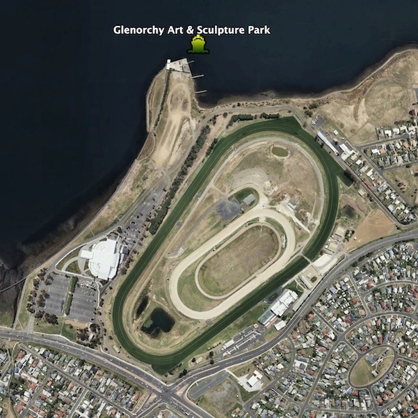
- Glenorchy Art & Sculpture Park (GASP) jetty
Bellerive ferry terminal upgrade
A development application for the upgraded Bellerive ferry terminal is due to be submitted to Clarence City Council by the end of October 2024. The development application process is expected to take 6-12 months with construction commencing once it is complete. This suggests construction commencing in 2025.
More Info
Engagement page for the River Derwent Ferry Service Masterplan
Email RiverDerwentFerries@stategrowth.tas.gov.au
Bellerive ferry terminal upgrade concept design announcement
Sandy Bay ferry terminal concept design
I have engaged with every level of government and made two submissions to the public consultation process. I have sent all lower house and local government elected representatives advice that raises serious concerns as to the environmental consequences of any ferry expansion without response.
The expanded ferry service can’t come fast enough (love to see an electric version). I’ve enjoyed the Bellerive service many times, although it’s a little walk for me to get to. The traffic is only worsening and with any interruptions anywhere near the CBD it comes to a standstill. We have a terribly underutlised river, this is an amazing opportunity to improve our transport woes and take some burden of the streets.