Endorsed by the Tasmanian government and Clarence, Glenorchy, Hobart and Kingborough councils in December 2021, the Greater Hobart Cycling Plan is the key document for cycling infrastructure development in Hobart.
What is the Greater Hobart Cycling Plan?
An interconnected network of bike paths across greater Hobart.
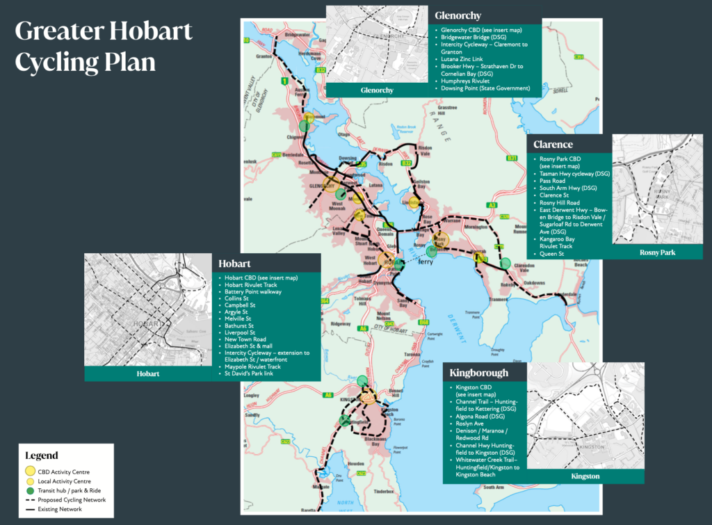
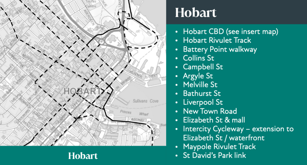
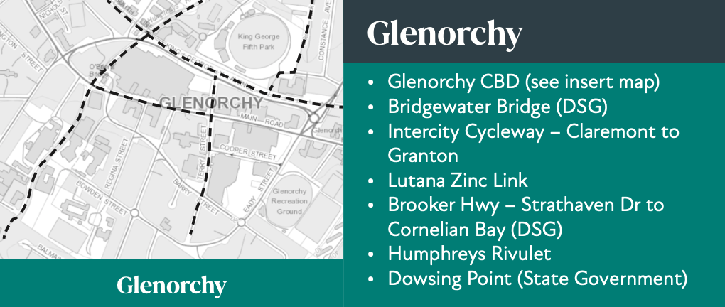
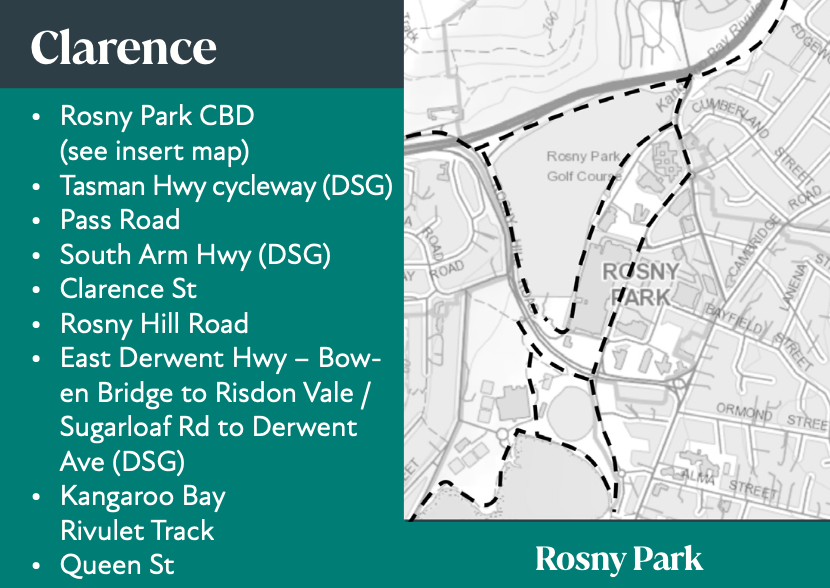
All paths to meet all ages and abilities (AAA) standard —suitable for most people including children, older people & inexperienced riders.

Our thoughts
The good
- Once fully implemented the Greater Hobart Cycling Plan will result in a connected network of important cycling routes. It will lead to an increase in people riding their bikes for transport and reduced reliance on private cars. It will also facilitate multi-modal transport by connecting to public transport like ferries.
- The plan specifies AAA standard, ensuring safe riding will be accessible to everyone.
- It’s been agreed to by all the relevant councils and the state government. This will hopefully ensure a unified and cooperative approach to implementation.
The less good
- It’s a guide to joint planning and investment — there’s no allocated funding or time goals. The similar Hobart Regional Arterial Bicycle Network Plan remains largely incomplete 15 years after it was released in 2009.
- While it will be a great start, it won’t be a complete network. Some obvious major routes like Sandy Bay Road aren’t included. It also specifies only a primary network and doesn’t include all the smaller local routes which will need infrastructure to ensure people can safely reach their destination.
Report card 2024-25
We’re now in financial year 2024-25. Three budgets and almost 3 years have passed since the plan was endorsed. How’s it going?
TL;DR: Exceedingly slowly.
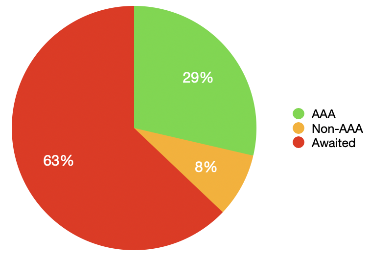
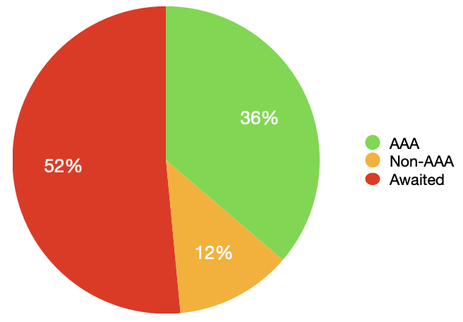
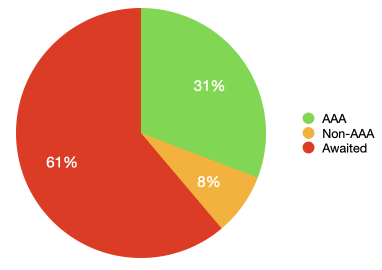
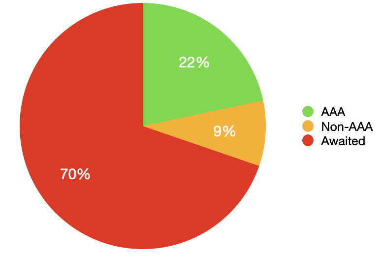
- 83 km of AAA paths
- 25 km of non-AAA standard paths
- 183 km without paths
291 km total
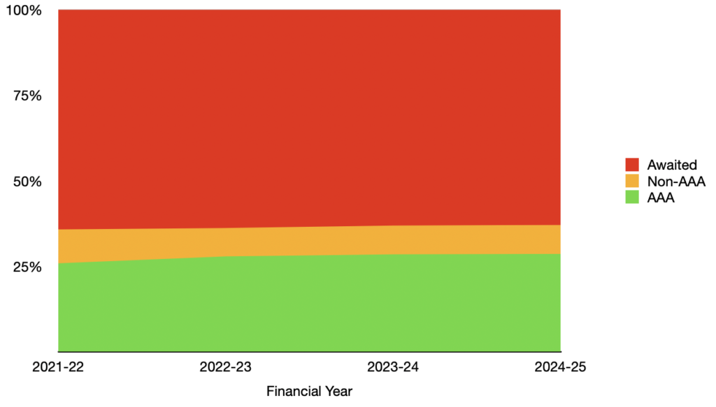
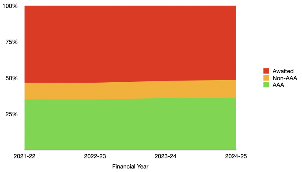
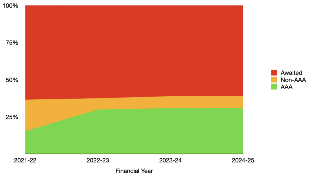
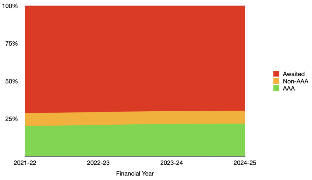
Almost 30% AAA standard paths doesn’t seem too bad after three years right? The issue is that’s almost exactly where it was when the plan was endorsed.
If we look at the progress from 2021 until now it’s virtually flat:
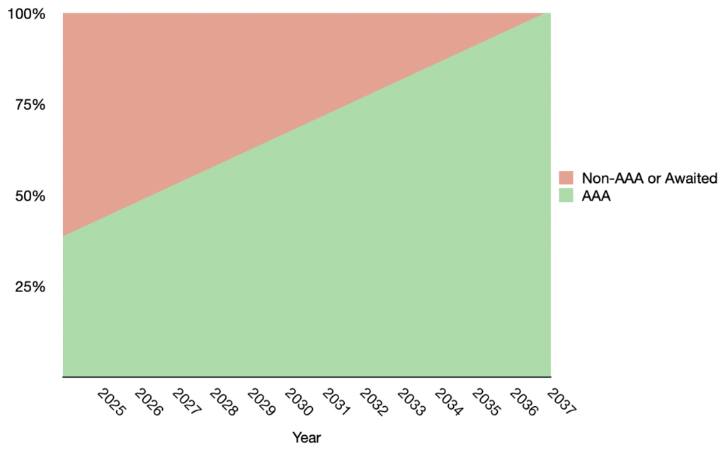
And if we use the progress to date and project when the Greater Hobart Cycling Plan will be completed:
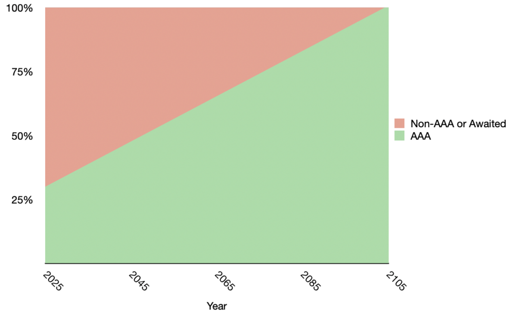
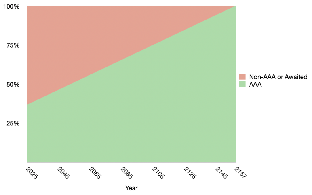
The year 2105. We’ll have a connected primary network of safe bike paths around Hobart some time next century!
There must be progress somewhere right? Well, let’s take a detailed look at how each of the four councils and the state government are going with their implementation.
City of Clarence
Status
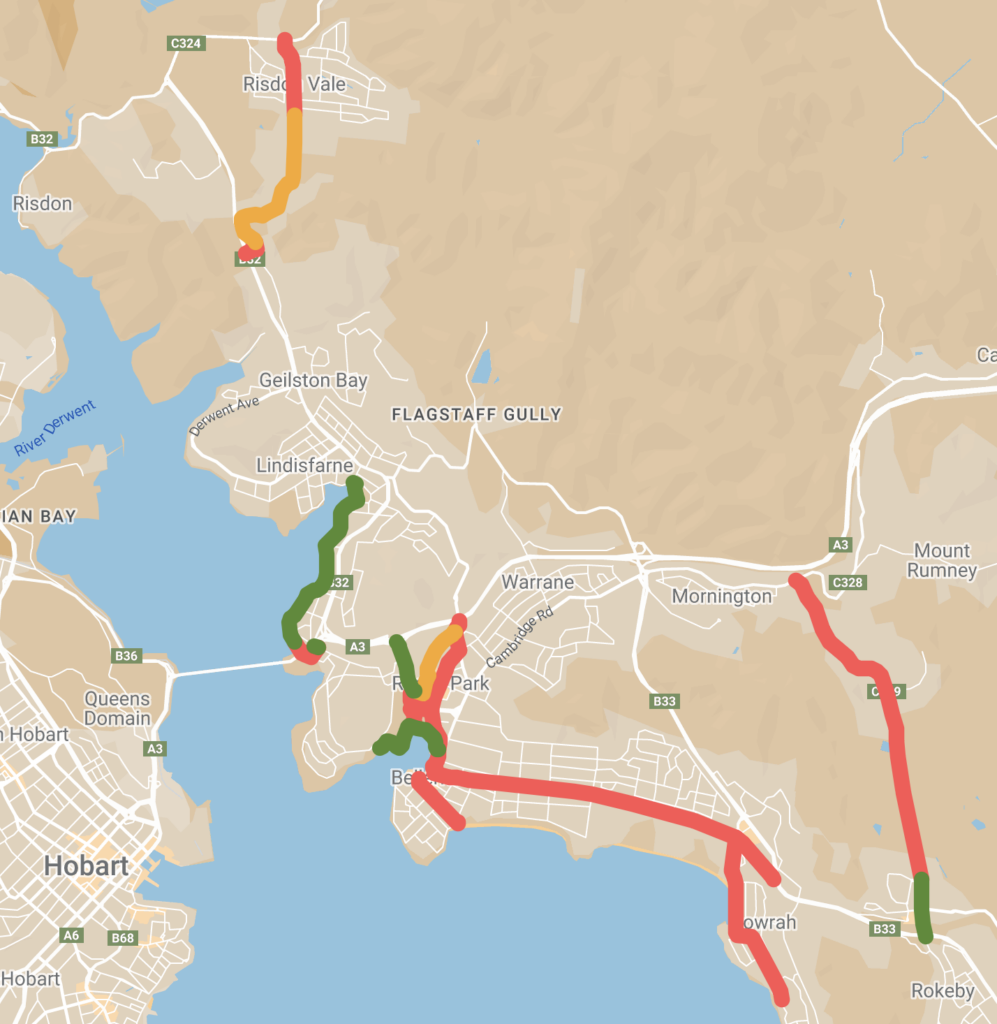
— green AAA standard
— orange non-AAA standard
— red awaited.
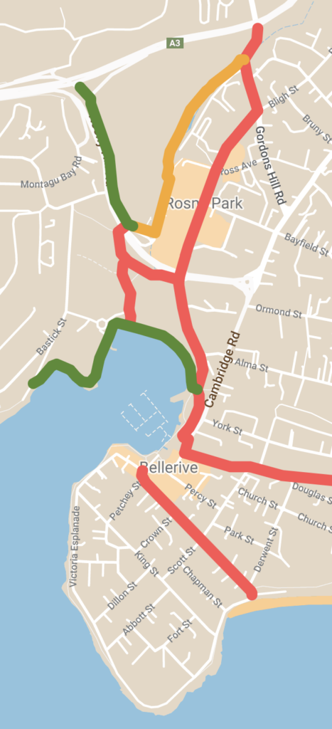
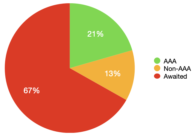
- 8 km of AAA standard paths
- 5 km of non-AAA standard paths
- 26 km without paths
39 km total
Progress
City of Clarence has not constructed or upgraded any paths in the plan since it was endorsed. (We haven’t bothered graphing it).
Future plans
The 2024-25 budget includes an allocation for designing a shared path along Queen Street on Bellerive Bluff. This might mean a further 600 m of bidirectional AAA standard shared path is constructed in 2025-26 (but it also might not).
Projection
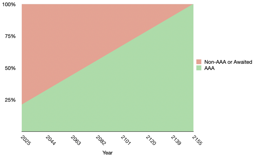
Based on the rate of construction to date, City of Clarence will never complete their part of the plan. In order to have something to base estimates on, let’s assume that they end up building the Queen Street shared path in 2025-26.
Based on the potential rate of future construction, City of Clarence will complete their part of the plan in the year 2155.
Comment
Clarence City Council has made improvements to the Clarence Foreshore Trail recently. However this has been in sections that aren’t included in the Greater Hobart Cycling Plan, presumably because they’re meandering routes perfect for recreation but not useful for transport.
It appears paths currently undergoing planning will be AAA standard but won’t separate people on bikes from people walking.
The lack of progress in Clarence is particularly disappointing given Clarence Street has got to be the lowest hanging fruit in the Greater Hobart Cycling Plan tree.
Glenorchy City Council
Status
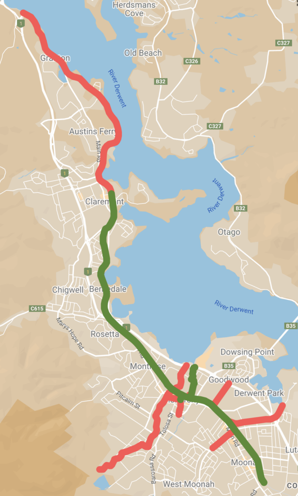
— green AAA standard
— orange non-AAA standard
— red awaited.
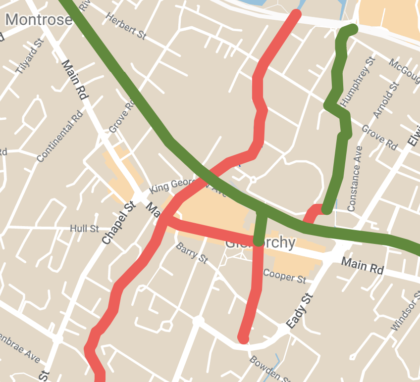
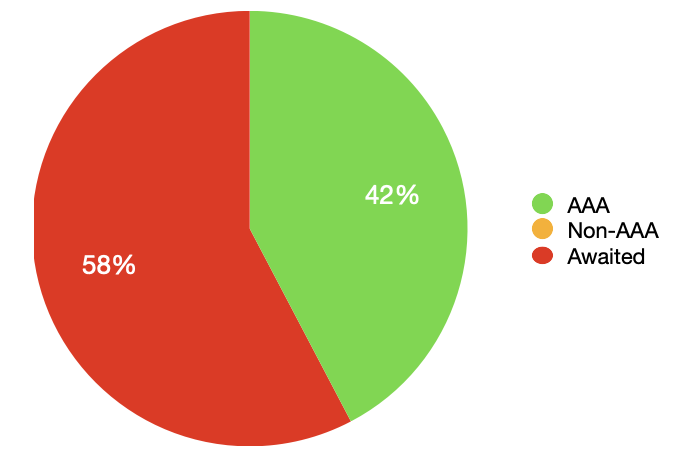
- 19 km of AAA standard paths
- 26 km without paths
45 km total
Progress
Glenorchy City Council has not constructed or upgraded any paths in the plan since it was endorsed. (We haven’t bothered graphing it).
Future plans
The 2024-25 budget includes an allocation for constructing a bidirectional shared path along Main Rd in Granton, connecting to the Bridgewater Bridge shared path being built by the state government. This will be 850 m of bidirectional AAA standard shared path. Inexplicably they’re also building 160 m of footpath where cycling infrastructure should be included. It will be 4.7 km on roads from this proposed shared path to reach the existing Intercity Cycleway in Claremont.
Projection
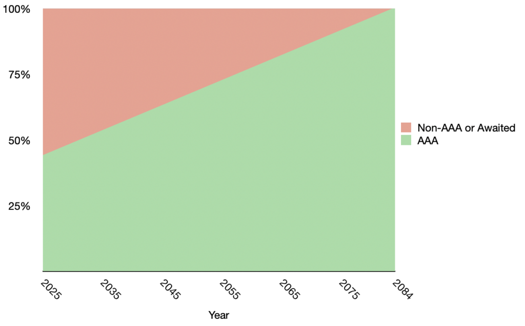
Based on the rate of construction to date, Glenorchy City Council will never complete their part of the plan. In order to have something to base estimates on, let’s assume that they end up building the Main Rd Granton shared path in 2024-25.
Based on the potential rate of future construction, Glenorchy City Council will complete their part of the plan in the year 2084.
Comment
The decades old Intercity Cycleway remains Glenorchy City Council’s only significant bicycle infrastructure and that doesn’t seem like changing any time soon.
It appears paths currently undergoing planning will be AAA standard but won’t separate people on bikes from people walking.
City of Hobart
Status
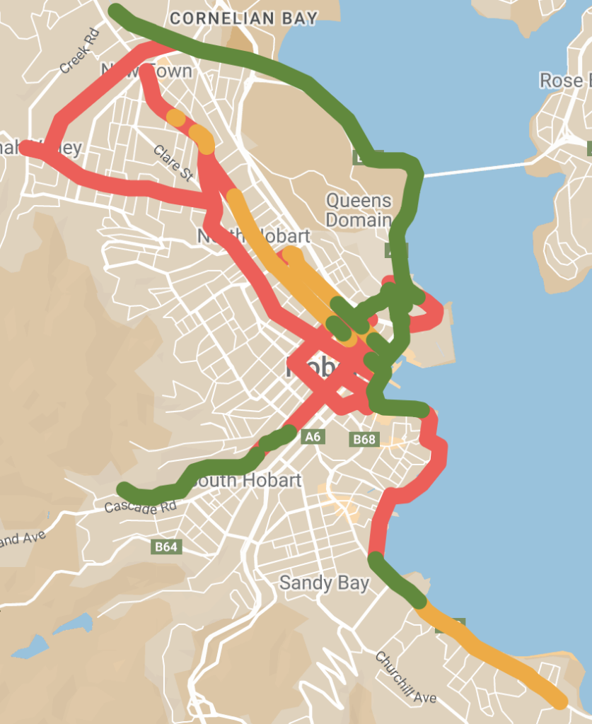
— green AAA standard
— orange non-AAA standard
— red awaited.
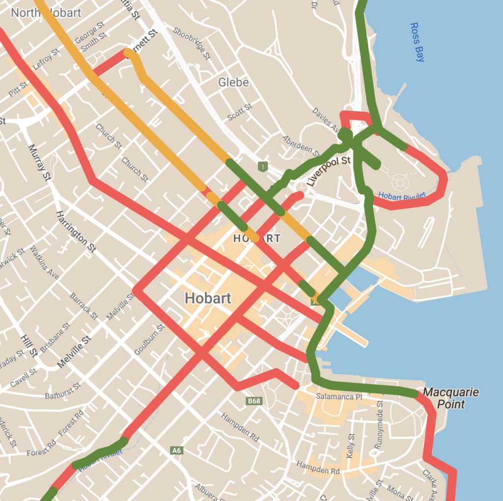
- 21 km of AAA standard paths
- 7 km of non-AAA standard paths
- 30 km without paths
58 km total
Progress
Since the plan was endorsed, City of Hobart has constructed:
| Campbell Street (Brisbane St to Davey St) | 550 m of unidirectional protected bike lane 180 m of unidirectional shared use lane (not AAA) |
| Argyle Street (Davey St to Brisbane St) | 190 m of unidirectional protected bike lane 170 m of unidirectional painted bike lane (not AAA) |
| New Town Road (near Roope Street) | 20 m (!) of unidirectional painted bike lane (not AAA) |
| TOTAL | 740 m of AAA standard bike paths 370 m of non-AAA standard bike paths |
implementing the Greater Hobart Cycling Plan.
Projection
Based on the rate of construction to date, City of Hobart will complete their part of the plan in the year 2157.
Future plans
- Construction of a protected bike lane on Bathurst Street between Argyle & Campbell Streets appears to be imminent. This will be AAA standard for 170 m in one direction.
- Construction of a protected bike lane on Liverpool Street between Campbell & Argyle Streets is planned but dependent on the reopening of the lane currently closed for RHH redevelopment works. When built it will be AAA standard for 170 m in one direction.
- Construction of protected bike lanes on Collins Street between Molle & Murray Streets is included in the 2024-25 budget. The draft design suggests this will be AAA standard in both directions for most of this 770 m section.
- Design of protected bike lanes on Augusta Road is included in the 2024-25 budget.
Comment
City of Hobart has made some progress on their part of the plan. They’re tackling routes that require reallocation of space from other road uses. They’re also creating infrastructure that separates people on bikes from people walking.
However not all the new infrastructure is AAA standard. Most importantly the rate of implementation is abysmally slow.
Kingborough Council
Status
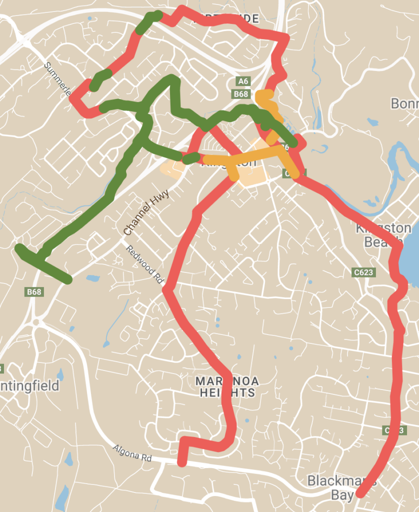
— green AAA standard
— orange non-AAA standard
— red awaited.
- 10 km of AAA standard paths
- 3 km of non-AAA standard paths
- 21 km without paths
34 km total
Progress
Since the plan was endorsed, Kingborough Council has constructed:
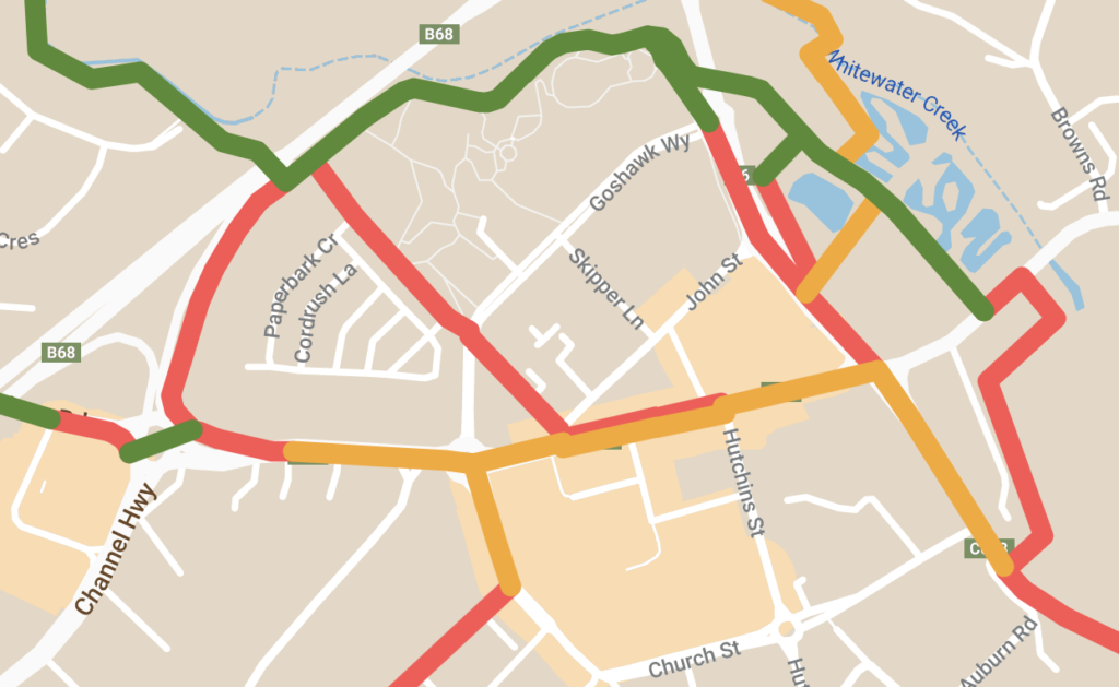
| Whitewater Creek Trail (Summerleas Rd to Channel Hwy) | 2490 m of bidirectional shared path (most of which was upgraded from a dirt walking track) |
| Channel Hwy (Kingston CBD) | 160 m of unidirectional painted bike lane (not AAA) |
| Drysdale Ave to Foley Rd | 160 m of bidirectional shared path |
| TOTAL | 5300 m of AAA standard bike paths 160 m of non-AAA standard bike paths |
implementing the Greater Hobart Cycling Plan.
Projection
Based on the rate of construction to date, Kingborough Council will complete their part of the plan in the year 2037.
Future plans
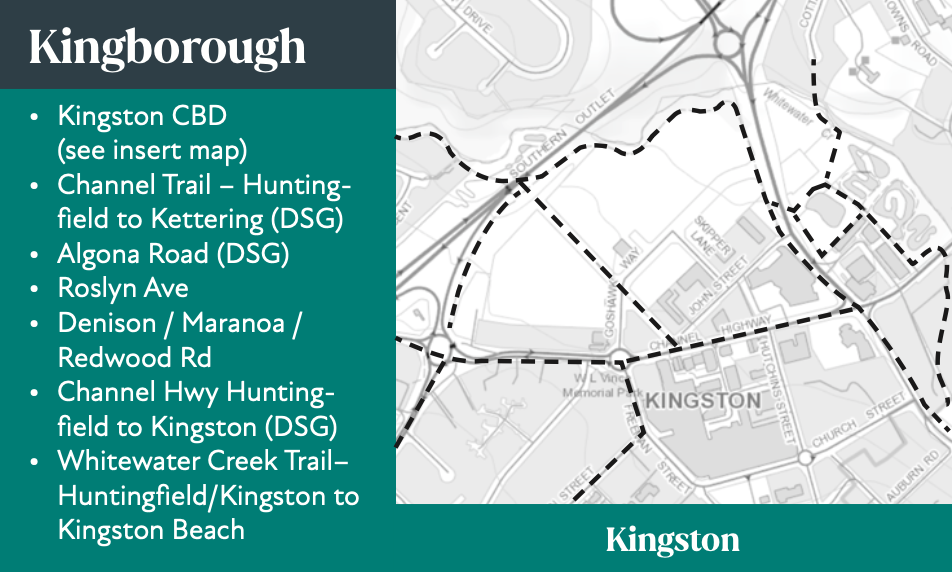
Kingborough Council included plans for two shared paths along the Channel Highway in their 2024-25 budget. This is a state road and is listed as a state government responsibility in the Greater Hobart Cycling Plan. Therefore we’ve listed these plans in the state government section below.
Comment
Construction of 2.5 km of bidirectional shared path along the Whitewater Creek Trail means Kingborough is the only council to have made an appreciable dent in the length of bike paths awaited under the plan. The new road underpasses means the path avoids intersections, improving safety and convenience. If the rate of construction is maintained, the council could complete its share of the plan in 16 years — not fast enough but lightning compared to the decades-centuries timelines predicted elsewhere in Greater Hobart. Kingborough Council is the only council with a cycling strategy.
The $8 million streetscape works in the Kingston CBD that resulted in a completely inadequate painted bike lane in one direction only was a missed opportunity and raises concerns about Kingborough Council’s commitment to AAA standard infrastructure outside of parklands. Aside from the 160 m non-AAA CBD bike lane, none of the new paths separate people on bikes from people walking. Lack of lighting along much of the Whitewater Creek Trail will mean many people won’t feel safe riding here after dark.
State Government
The Department of State Growth is responsible for bike paths along state roads (essentially the highways). These are spread across all council areas, though vary significantly in their extent.
Status
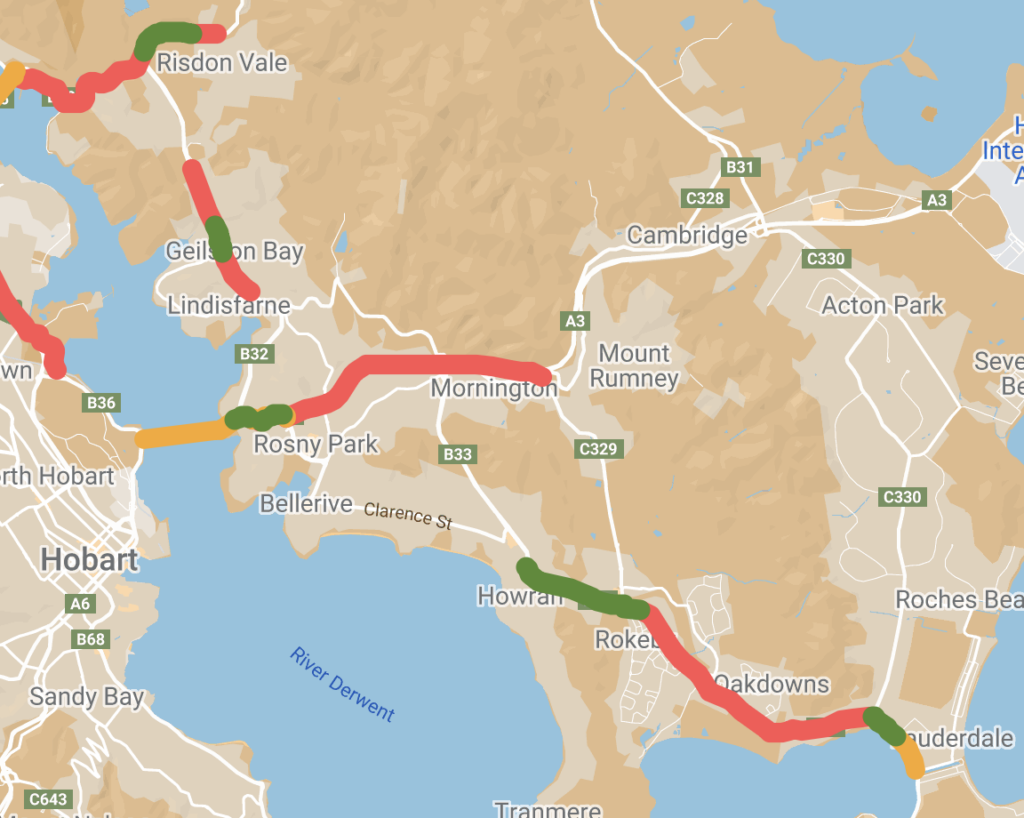
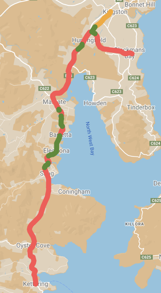
Current status of the State Government’s bike paths
— green AAA standard
— orange non-AAA standard
— red awaited.
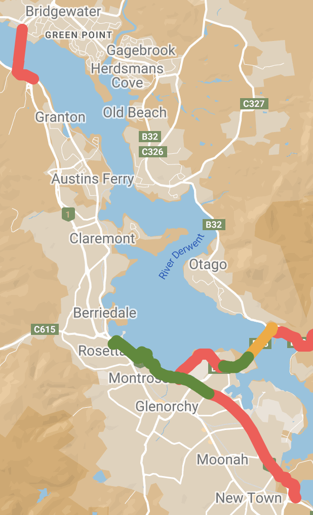
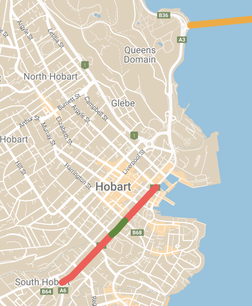
- 25 km of AAA standard paths
- 10 km of non-AAA standard paths
- 81 km without paths
116 km total
Progress
Since the plan was endorsed, the State Government has constructed:
| Davey Street (Harrington St to Barrack St) | 220 m of unidirectional protected bike lane |
| Huntingfield roundabout | 430 m of bidirectional shared path |
| East Derwent Highway (Golf Links Rd to Geilston Creek Rd ) | 450 m of bidirectional shared path |
| TOTAL | 1980 m of AAA standard bike paths |
implementing the Greater Hobart Cycling Plan.
Projection
Based on the rate of construction to date, the State Goverment will complete their part of the plan in the year 2156.
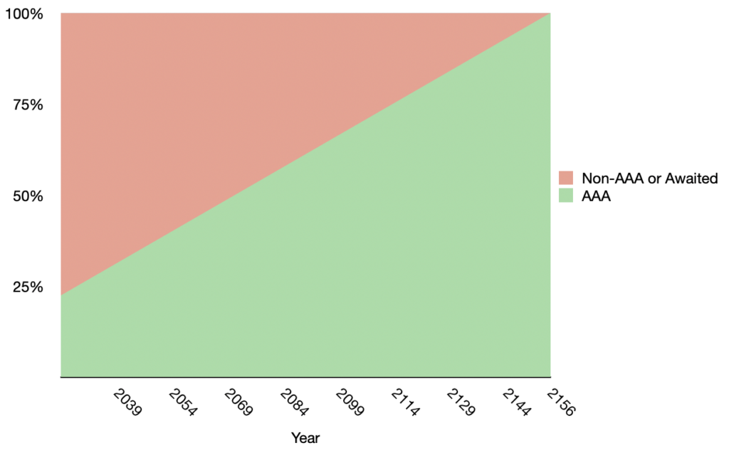
Future plans
- Construction of the new Bridgewater Bridge is already well underway. It’s scheduled to open some time in 2025 and will include 1.7 km of bidirectional AAA standard shared path.
- Construction of a section of shared path along the Channel Highway near Coningham between Davies & Old Station Roads is planned for 2024-25. Although it’s a state road, Kingborough Council are building the path with the State Government contributing some money through an active transport grant. This will be 200 m of bidirectional AAA standard shared path.
- Design of a shared path along the Channel Highway between Kingston CBD and Hunting field is budgeted for 2024-25. Again this is being done by Kingborough Council although it’s a state road. This will be about 1.4 km, in both directions and presumably AAA standard.
Wide shared paths on the Tasman Bridge are in the design phase— the revised upgrade plan no longer includes AAA standard shared paths.
Comment
The State Government has made a skerrick of progress. All new infrastructure is AAA standard. One of the three projects separates people on bikes from those walking.
Construction of the new bike infrastructure has been opportunistically tacked on to road projects, rather than being projects in their own right. And it shows — none of the new bike infrastructure in any way connects to the rest of the network. Once again the rate of construction is preposterously slow.
What can I do?
Not impressed with the progress your council and state government have made so far? Concerned you and your kids won’t ever get to ride around Hobart safely? Let the councils, government and your elected members know how important this is. See our Get Involved page to find out how.
More info
Greater Hobart Cycling Plan on the Infrastructure Tasmania website