City of Clarence will enhance walking & riding on Bellerive Bluff with extensive street improvements to Queen Street & Victoria Esplanade, including shared paths along their lengths.
What’s the plan?
City of Clarence has developed a master plan for both Queen Street and Victoria Esplanade on Bellerive Bluff.
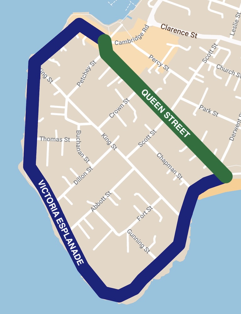
Queen Street
Queen Street is a flat, straight street that crosses the width of Bellerive Bluff, roughly 600 m in length. It directly connects Bellerive pier & village at one end with the beach & oval at the other end, making it a key active transport route.
Here’s the plan for Queen Street, starting from the pier / village and travelling south-east to the beach / oval.

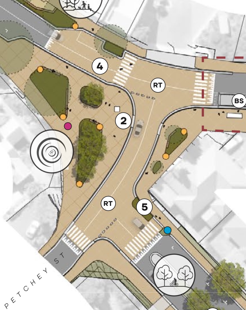
At Petchey Street
- Realignment of the intersection of Queen & Petchey Streets — labelled (2)
- The entire Queen / Petchey / Cambridge intersection made into a raised table with multiple pedestrian crossings.
- The start of a 3 m wide bidirectional shared path the length of the southern/western side of Queen Street.
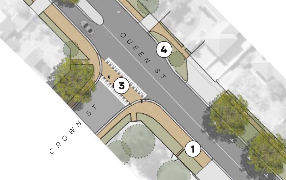
At Crown Street
- The 3 m wide bidirectional shared path continuing — (1)
- Raised crossing at Crown Street intersection — (3)
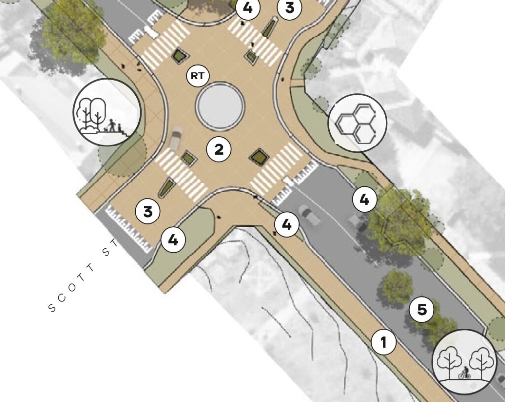
At Scott Street
- The 3 m wide bidirectional shared path continuing — (1)
- Mini roundabout and raised table with multiple pedestrian crossings at Scott Street intersection — (2)
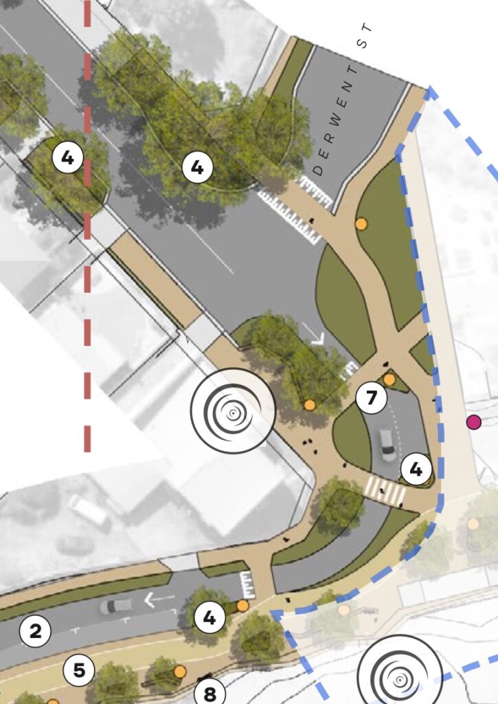
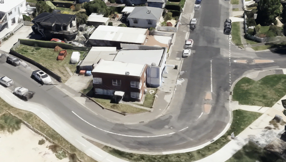
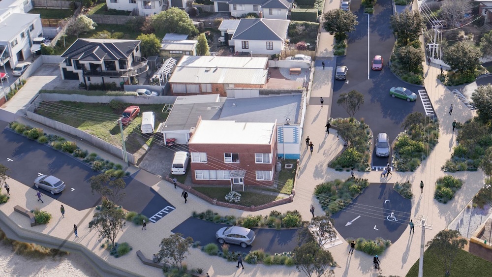
At Derwent Street / Victoria Esplanade
- The end of the 3 m wide bidirectional shared path connects to pedestrian crossings with road narrowing and raised table — (7)
- One way westwards traffic along the esplanade from Queen Street to Chapman Street — (2)
- This allows for the bidirectional shared path to be widened to 3 m — (5)
- Raised pedestrian crossing at Derwent Street intersection.
Victoria Esplanade
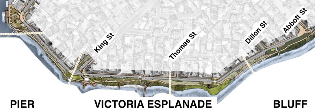
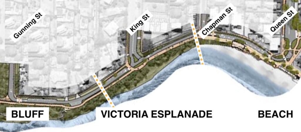
Victoria Esplanade also connects Bellerive pier & village with the beach & oval. Unlike Queen St however, it takes a meandering 1.6 km route along the coast and around the bluff. It’s a great recreational route.
Here’s the plan for Victoria Esplanade, starting from Bellerive Pier and travelling south to the bluff and then north-east to Bellerive Beach and Bellerive Oval.
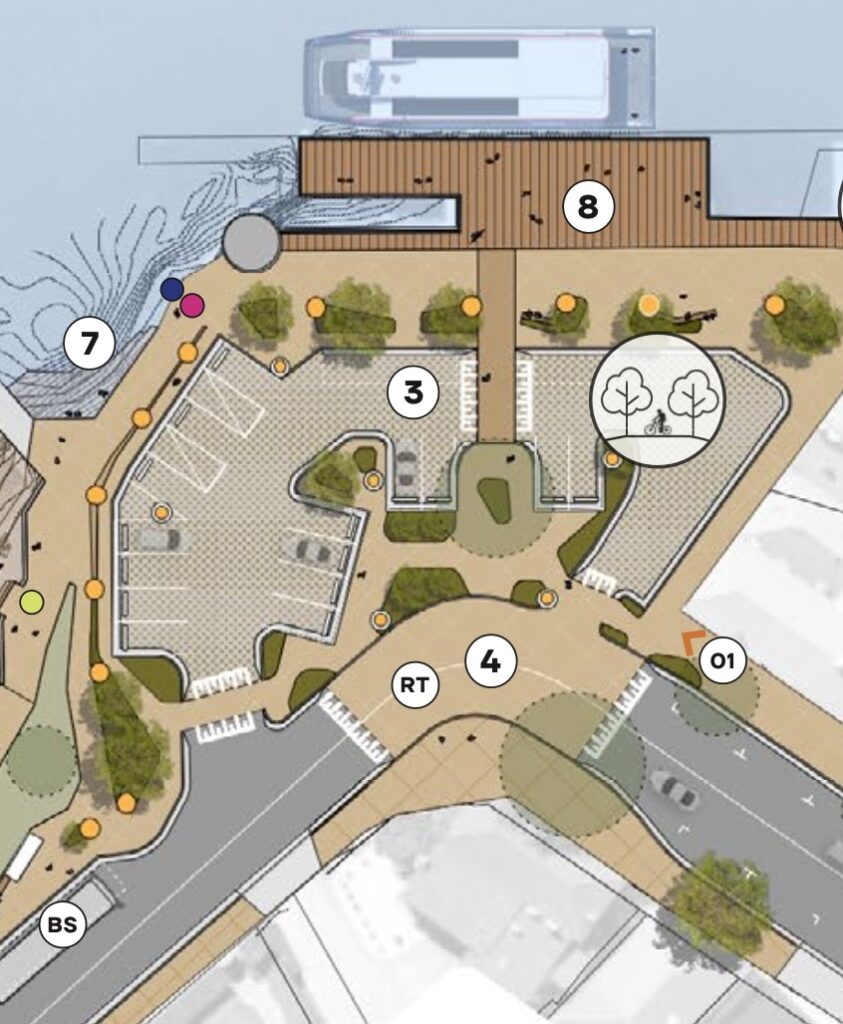
At Bellerive Pier
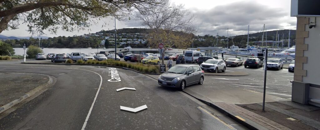
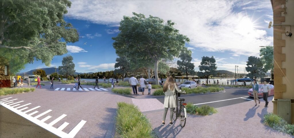
- Revised carpark layout for better pedestrian access, all abilities access, drop off & pick up, slower traffic speeds — (3)
- Raised table for pedestrian priority, slower traffic speeds — (4)
- A bus stop — (BS)
- Terraces — (7)
At King Street
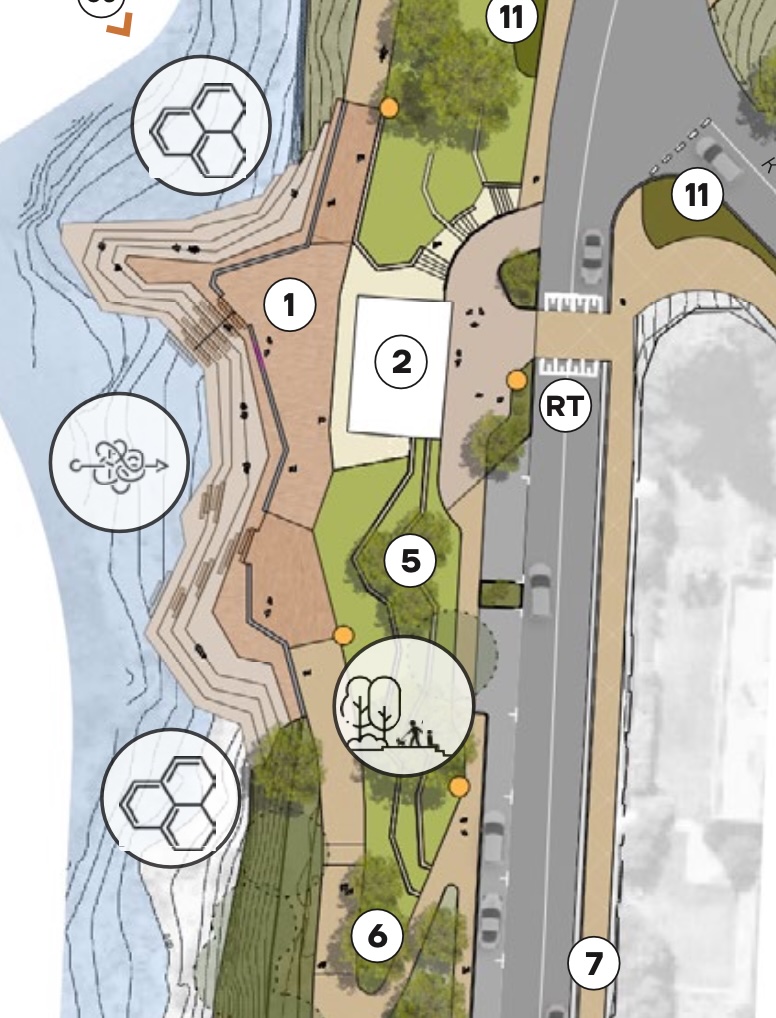
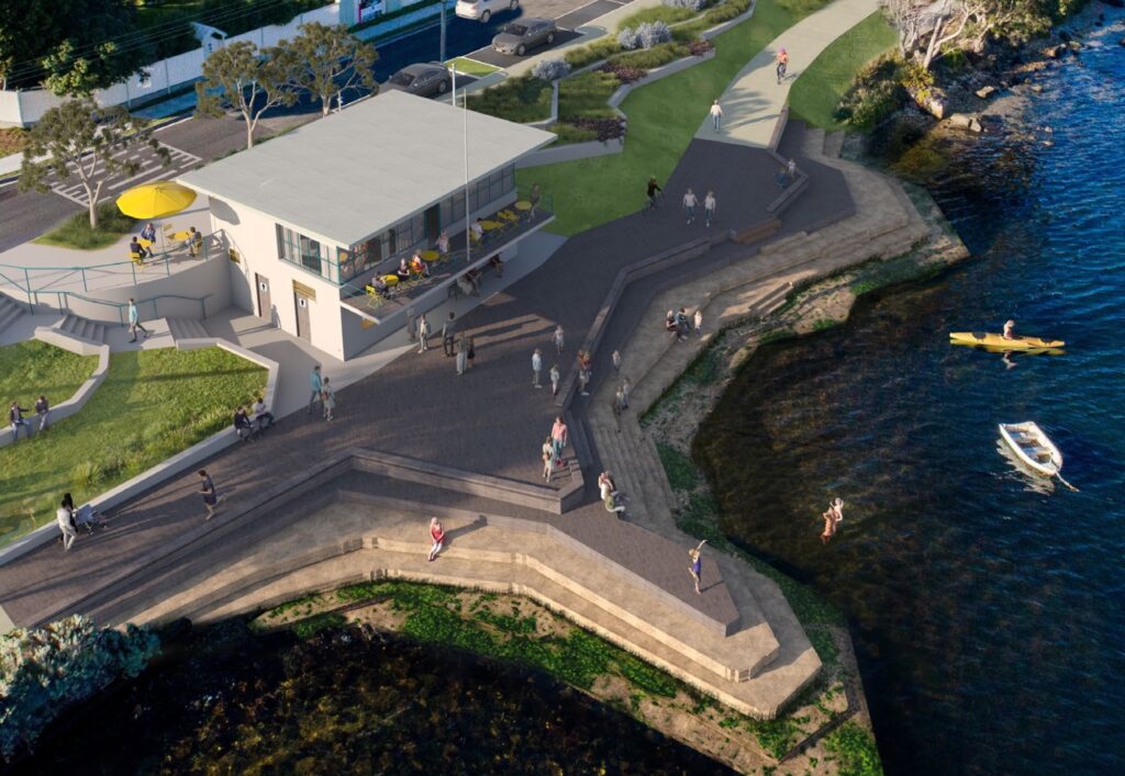
- Bidirectional shared path widened to 3 m — (6)
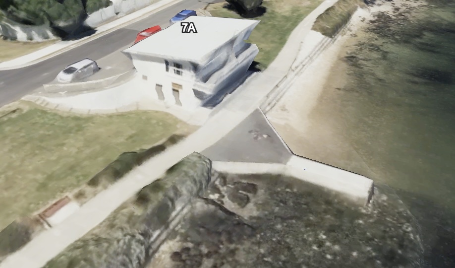
- Plaza & terraced seating — (1)
- Pavilion converted to cafe with outdoor dining on the verandah and in a new forecourt — (2)
- Upgraded public toilets underneath cafe — (2)
- Raised pedestrian crossing — (RT)
- Parking moved to street level.
At Abbott Street
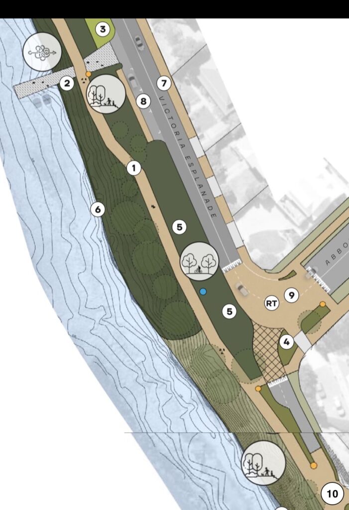
- Bidirectional shared path widened to 3 m — (6)
- Repaired ramp for kayak launching — (2)
- Grassed area for kayak wash down — (3)
Raised table directing through traffic onto Abbott Street — (9)— removed from final planRoad closed to traffic allowing for a wide foreshore trail for people walking and cycling around the bluff — (10)— removed from final plan
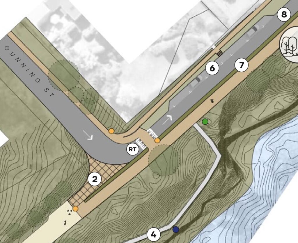
At Gunning Street
On the other side of the bluff:
Road closed to traffic until Gunning Street — (2)— removed from final plan- One way eastwards traffic from Gunning Street to King or Chapman Street — (8)
- This allows for a wider bidirectional shared path separated from the road by raised planted strips instead of the existing steel cable fence — (7)
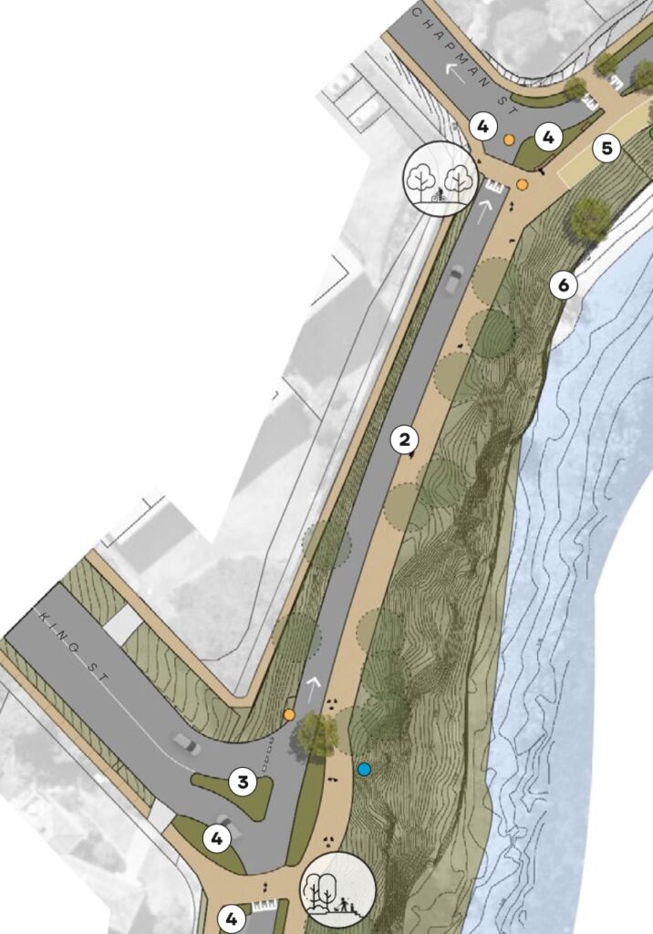
At King & Chapman Streets
- Victoria Esplanade possibly closed to traffic between King & Chapman Streets to allow for an appropriate width of shared path — (2)
- A turning circle at the end of King Street if the road is closed — (3)
- One way westwards traffic along the esplanade from Queen Street to Chapman Street — (4) — subject to further study & consultation
- This allows for the bidirectional shared path to be widened to 3 m — (5)
- Raised pedestrian crossings.
Our thoughts
The good
- The changes will make Queen Street a safer and more pleasant place for active transport. It’s an important route, connecting Bellerive oval with the ferry terminal at Bellerive Pier, and is part of the Greater Hobart Cycling Plan.
- Similarly, changes to Victoria Esplanade will make this important recreational route along the coast an even safer and more pleasant place to walk & ride. There’s also many changes that will make it a more interesting place to hang out and explore.
- Traffic calming measures will create an environment that encourages safe vehicle speeds by design.
- A new bus stop at the pier will improve public transport connections to the ferry.
- There’s lots of modern street design features throughout. For example, greenery and water sensitive urban design features to slow, absorb & filter storm water.
- It’s great to see a timeline for implementation.
The less good
- In relation to the Queen Street shared path, the final plan states: further changes to parking allocation and cycleway require further investigation and consultation with adjacent residents prior to any changes to existing parking and road widths. There is a significant risk that the design will be compromised to a point it doesn’t serve its purpose of providing a shared path that can be safely used by people of all ages and abilities.
- Event crowds will result in too many people walking on the Queen Street shared path for people to be able to ride as well. Given these high numbers at peak periods, the ideal scenario would be to have separate paths for walking and riding here.
- Traffic free sections of Victoria Esplanade around the bluff and between King & Chapman Streets would have created a significantly better space for recreational use while maintaining vehicular access to all properties. It’s disappointing this was removed from the final plan.
Where’s it at?
Implementation will occur in stages over the next 9 years:
| Financial Year | Design | Construction |
|---|---|---|
| 2024/25 | Stage 1 — Pier & Victoria Esplanade Precinct Stage 2 — Pavilion Precinct | |
| 2025/26 | Stage 3 — Queen St North & South | Stage 1 — Pier & Victoria Esplanade Precinct |
| 2026/27 | Stage 4 — Victoria Esplanade / Queen St Precinct | Stage 2 — Pavilion Precinct |
| 2027/28 | Stage 5 — Point Precinct North & South | Stage 3 — Queen St North & South |
| 2028/29 | Stage 6 — Bluff Precinct East & Central | Stage 4 — Victoria Esplanade / Queen St Precinct |
| 2029/30 | Stage 7 — Bluff Precinct West | Stage 5 — Point Precinct North & South |
| 2030/31 | Stage 8 — Cambridge Rd & Bellerive Village | Stage 6 — Bluff Precinct East & Central |
| 2031/32 | Stage 7 — Bluff Precinct West | |
| 2032/33 | Stage 8 — Cambridge Rd & Bellerive Village |
Previously:
- Initial community consultation occurred in 2019.
- The draft Master Plan was released for community consultation April–May 2023.
- The final Master Plan was adopted by the council in October 2024.
More info
Victoria Esplanade & Queen Street Master Plan (starts page 208) — City of Clarence